St. Louis residents should keep umbrellas handy this week as the National Weather Service forecasts a series of thunderstorms across the region, with varying chances of precipitation throughout the week.
Today's weather could bring showers and thunderstorms with a 50 percent chance before 5 p.m. and should see cloudy skies and moderate high temperatures around 74 degrees, according to NWS St. Louis, expect winds shifting from southwest to northwest in the afternoon that could bring gusts as high as 20 mph, tonight's forecast also indicates a 40 percent chance of showers and thunderstorms primarily after 2 a.m. and a drop in the low temperature to about 56 degrees.
Wednesday's outlook is wetter with the likelihood of precipitation rising to 70 percent, featuring potential showers and thunderstorms before 2 p.m., followed by intermittent showers and possible thunderstorms until evening, when the probability jumps to 80 percent. "Showers likely and possibly a thunderstorm after 4pm," as stated by the NWS St. Louis update.
Thursday promises no respite from the damp conditions, as thunderstorms remain on the cards, carrying a near-certain 100 percent chance; the high for the day is predicted to be near 77, with a continuation of southwest winds at speeds of up to 13 mph, which may bring gusts as strong as 22 mph into the mix, the likelihood of showers tapers off slightly on Thursday night with a 30 percent chance before transitioning into a clearer Friday.
Beyond the wet and stormy midweek, the weekend outlook appears to be sunny with highs in the upper 60s to mid-70s. According to the detailed forecast by NWS, St. Louisians can expect clearer skies starting Saturday, leading to a brighter and more predictable start into the next week.
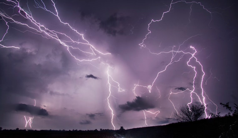
Alongside the regular weather updates, the NWS St. Louis has also issued a Hazardous Weather Outlook for the region. While severe weather is not expected to be widespread today, "a few storms could become strong to severe with damaging winds and large hail the primary threats," as the Outlook details. Spotter activation, critical for real-time, ground-truth information during severe weather events, may be required in some of these scenarios.


