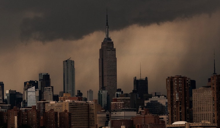
New Yorkers should brace for an unsettled weather pattern with chances of severe thunderstorms and a looming heat wave, according to the National Weather Service (NWS). Starting today, residents across the five boroughs, including Manhattan, Brooklyn, Queens, The Bronx, and Staten Island, are likely to experience showers, thunderstorms, and increasing clouds, with the potential for severe weather conditions, including damaging wind gusts, heavy rain, and possible hail.
Today's forecast anticipates areas of fog before 11am and a chance of showers followed by likely thunderstorms after 2pm, the weather service said there's a 60-70% chance of precipitation with new rainfall amounts ranging from a quarter to half of an inch possible in certain areas, such as Manhattan, where the high could reach 82 degrees, while tonight may bring a slight respite with a slight chance of showers between 8pm and 11pm and lows hovering around the low 70s across the city.
The Juneteenth holiday could see temperatures rising close to the 90s, with severe storm potential escalating in the afternoon and heat index values pushing as high as 95 to 96 in some areas like The Bronx, signaling the start of an opressive heat that's expected to peak early next week, where Monday temperatures could soar to mid-90s, with Manhattan and The Bronx expecting a scorching 96 and 97 degrees, respectively, by Tuesday, the NWS forecasts suggest a sultry trend that could extend well into the week with few, if any respite.
As the city prepares for this intense weather, the NWS warns of an upward tick in ailments typically associated with such conditions—heat exhaustion, heatstroke, and the aggravation of chronic heart and lung diseases, they urge the public to take necessary precautions, such as staying hydrated and limiting outdoor activities, particularly in the early next week when the heat wave is expected to take hold. While the NWS has not yet issued heat advisories, their Hazardous Weather Outlook alerts the public to the elevated risk of severe weather on Thursday and the possibility of an isolated tornado, additionally, coastal waters have been flagged for dense fog advisories with potential for scattered severe thunderstorms threatening gusty winds and frequent lightning, particularly on Thursday afternoon and evening.
State weather officials have been actively monitoring the evolving pattern, stressing the importance of staying updated through reliable sources. "Continue to monitor the forecast for details on this potentially significant heat wave," the Hazardous Weather Outlook advises. Spotter activation has been flagged as unlikely at this time, but this could change with the impending stormy conditions intensifying, possibly leading to new advisories or warnings that would be vital for the safety of the city's residents and visitors.


