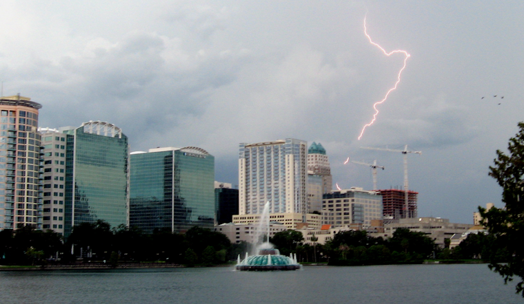
As the clouds gather over Orlando, it's not just the heat you'll need to watch out for. The National Weather Service Melbourne FL is forecasting an increase in shower and storm activity heading into the weekend. There's a "Marginal Risk" for severe weather, which ranks 1 out of 5 on the severity scale, through Friday. What's more, with heat indices set to reach the 100 to 105 mark, health officials are reminding people to take the necessary steps to avoid heat-related illnesses—an imperative as simple as "Look before you lock!"
Beachgoers should also take heed; the National Weather Service has flagged a "Moderate risk of rip currents" continuing through the weekend. In the meantime, today's temperatures are expected to range from the upper 80s to the lower 90s, creating an increasingly humid atmosphere that could quickly intensify the heat. To keep cool and healthy, hydration and seeking shade are key, especially during peak sunshine hours. The evening brings some respite with expected overnight lows resting in the 70s.
For those planning outdoor excursions, the afternoon could bring more than just a sprinkle. Friday through Sunday, showery conditions are forecasted to intensify, with a 60-70% chance of precipitation. A handful of these could turn strong or even marginally severe—particularly on Friday—bolstered by some drier air aloft, according to the forecast discussion from the National Weather Service. "A few strong to marginally severe storms will remain possible, particularly on Friday," states the early morning forecast discussion.
Boaters, too, should plan to navigate carefully. The marine outlook suggests "Generally favorable boating conditions," but with caveats. A spike in offshore-moving showers and storms is possible this weekend and into next week. The National Weather Service warns, "A few storms could be strong to marginally severe as they approach the coast, especially Friday." Mariners will want to keep an eye out for rogue lightning, gusty winds, and downpours that could mirror the unsettled skies of the week.
Looking ahead to Independence Day, it seems the climate refuses to cease its dramatic flair. Another mid-to-upper-level low-pressure system is expected to enter the scene, keeping the atmosphere rich in moisture and primed for precipitation. Temperatures are expected to remain in the lower 90s, but with increasing humidity, the "feels-like" temperatures could once again reach those searing 100s.


