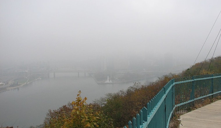
Pittsburgh residents woke up to a blanket of fog early this morning, leading the National Weather Service (NWS) to issue a Dense Fog Advisory that remained in effect until 9 AM. The advisory targeted areas along Pennsylvania and Ohio's I-80 and I-70 corridors, as motorists faced reduced visibility on their morning commutes. Stratus clouds helped deter widespread low visibility elsewhere, resulting in only a Special Weather Statement for those areas. Information about the advisory can be found on the NWS's website.
According to the NWS's updated Area Forecast Discussion, the fog was driven by clear skies behind an exiting cold front and lingering moisture at the surface. The Pittsburgh region is set to experience a reprieve from significant weather events post-fog, with "mostly dry and quiet conditions" expected for the remainder of the day. The possibility of a stray shower this afternoon during peak heating remains, though any potential development is considered low probability. As we head into the night, temperatures will hover around the mid-80s, aligning with seasonal norms.
The short-term forecast portends some intermittent weather action as we approach the Fourth of July weekend. Thursday might see "isolated thunderstorms" in the afternoon, as stated in the NWS's report. Despite the "very dry air aloft" which could stifle thunderstorm activity, there's still a suggested 20-35% chance for rain, primarily across Pennsylvania. Individuals looking forward to the Fourth can expect sunny skies and dry weather, perfect for any planned festivities and evening fireworks, with temperatures below average.
The weekend outlook suggests a dry and warm Saturday with a high-pressure system. Those hoping to enjoy outdoor activities should do so comfortably with highs predicted to approach 90°F in certain areas, notably eastern Ohio and within Pittsburgh's urban heat island. Come Sunday and into next week, the weather pattern shifts with "daily shower and thunderstorm chances returning," as per the NWS prediction. Temperatures remain hot and humid, with a 70-90% chance for thermometers to hit or exceed the 90-degree mark, ensuring an authentically summery feel for the latter part of the weekend.
Fog has led to early morning disruptions in aviation, with IFR conditions prevalent across several airports. "The fog should quickly dissipate," according to forecasts, and give way to VFR (Visual Flight Rules) conditions that are expected to prevail through Sunday as a ridge of high pressure takes over. For those hitting the skies, or merely looking upward, means predominantly clear views ahead.


.jpg)