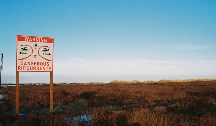
The National Weather Service in Jacksonville, FL has issued a high rip current risk warning that is now extended through Saturday evening for Northeast Florida beaches. The announcement, made early Friday morning, cautions beachgoers about dangerous rip currents that can "sweep even the best swimmers away from shore into deeper water."
Specifically, this rip current statement affects Coastal Nassau, Coastal Duval, Coastal Flagler, Northeast Coastal St. Johns, and Southeast Coastal St. Johns. Residents looking to cool off in the late-August heat should take extra care if they choose to enter the water. The NWS advises to "swim near a lifeguard," and in case one is caught in a rip current, it's crucial to "relax and float." Those who find themselves unable to escape should "face the shore and call or wave for help."
This comes alongside a forecast of showers and thunderstorms for the region, with the probability of rain at 80% and projected new rainfall amounts between a quarter and half an inch possible in various periods over the next several days. NWS Jacksonville indicates that today's weather will see showers and thunderstorms mainly after 2pm with highs nearing 90 degrees and calm winds becoming south at 5 to 7 mph in the afternoon.
The extended forecast predicts similar patterns for the upcoming week with chances of showers and thunderstorms, especially in the afternoon and evenings. On Monday, when most revelers will seek the last of their weekend joys, showers and thunderstorms are likely after 2pm, with the sun peeking through to push temperatures close to 91 degrees, despite a 60% chance of precipitation. For those planning outdoor activities, it may be wise to schedule them in the morning to early afternoon to avoid the expected downpour.


