Minneapolis residents faced another day of unpredictable weather Monday with the National Weather Service issuing a hazardous weather outlook early in the morning. Showers and thunderstorms were likely before noon with mostly cloudy skies and a high near 84 degrees, according to a forecast obtained from National Weather Service. A south southeast wind was expected to turn west in the afternoon, and the chance of precipitation stood at 70 percent. The new rainfall amounts could be less than a tenth of an inch, but with thunderstorms, higher amounts were possible.
As the night approached, the risk of severe weather appeared to decrease with the only concern being patchy fog developing after 1:00 a.m. Despite the storms rolling out, Twin Cities residents could anticipate partly cloudy skies and a low around 68 degrees. While the National Weather Service looked ahead to Tuesday with a more optimistic forecast predicting mostly sunny skies and a high near 83 degrees, the immediate concern remained the potential for flooding.
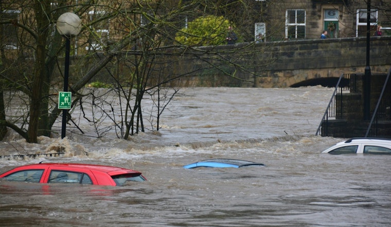
The flood watch remained in effect until 10 a.m. this morning for multiple counties, denoting the possibility of flash flooding due to excessive rainfall. The National Weather Service's Flood Watch alert stated, “Excessive runoff may result in flooding of rivers, creeks, streams, and other low-lying and flood-prone locations. Flooding may occur in poor drainage and urban areas. Extensive street flooding and flooding of creeks and rivers are possible.” Residents were urged to stay informed and prepare to take action should flash flood warnings be issued.
While the outlook for the following days appeared to be mild, with no hazardous weather expected from Tuesday through Sunday, Minnesotans were still reeling from the heavy rainfall. The flood watch highlighted the fact that localized rainfall amounts of 4 or more inches could compound the already saturated soils. It was suggested that area creeks and streams, running high, could flood with more heavy rain. The situation underscored the delicate balance between the serene summer days to come and the immediate threats posed by Minnesota's current flood watch.


