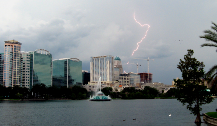
In an update that has many Orlando residents looking skyward, the National Weather Service Melbourne FL is cautioning locals of the continued high risk of life-threatening rip currents at all Atlantic beaches in Central Florida. According to a forecast discussion issued at 204 AM EDT, Sun Aug 24 2025, the weather pattern suggests an unsettled early week with a higher-than-normal chance for showers and storms. Locals should expect occasional lightning and the possibility of minor flooding due to locally heavy rain.
Driving rich tropical moisture over Florida, a stalled front and weakness in pressure along the I-10 corridor have contributed to the wet conditions. As these meteorological features continue to influence weather patterns, Central Florida folks should prepare for a continuation of this soggy and stormy scenario through at least Tuesday. While a return to more typical afternoon and evening storms is expected by mid to late this week, the National Weather Service indicated, the forecast supports above-normal rainfall as we wrap up August.
Looking at the seas, mariners aren't out of troubled waters yet. Swells from former Hurricane Erin will continue affecting the region, with seas ranging between 3-5 feet, and at times reaching up to 6 feet offshore through tonight. These conditions are projected to persist for a couple of days before calming down midweek. Southwest winds will likely stay active at around 15 knots with occasional gusts up to 20 knots through Monday.
For those considering a flight in or out of Orlando, the aviation weather outlook isn't without its turbulence. The deep W/SW flow across the region maintains high chances for disruptive weather patterns, including scattered to numerous showers and storms that can lead to gusty winds and temporary IFR/MVFR conditions for aviators. This activity will lead to gusty winds and IFR/MVFR conditions, with a few stronger storms producing strong wind gusts to 35-45 knots, warns the National Weather Service.
As Central Floridians navigate the wet and windy conditions, the week ahead promises no immediate respite with scattered to numerous showers and storms still lurking in the forecast. While temperamental Mother Nature plays out her late summer theatrics, the consistent message ringing out is one of vigilance and preparedness as the state faces an abundance of elemental unrest.


