The National Weather Service in Jacksonville has issued updates for the residents of Florida's First Coast, extending a Coastal Flood Advisory until 8 PM EDT Monday, alongside an ongoing High Rip Current Risk through Monday evening. Residents in the affected areas, including Coastal Duval, Coastal Flagler, Northeast Coastal St. Johns, and Southeast Coastal St. Johns counties, should be aware of minor coastal flooding and the potential danger posed by rip currents and rough surf.
According to the advisory, flooding could impact lots, parks, and roads, with isolated road closures possible. The NWS advises caution, suggesting that if travel is require, extra time should be allotted for potential road closures and not to drive through water of unknown depth. Local authorities are expected to take necessary actions in protecting flood-prone properties. For those considering beach visits, swimming near a lifeguard and adhering to safety guidelines for rip currents is essential.
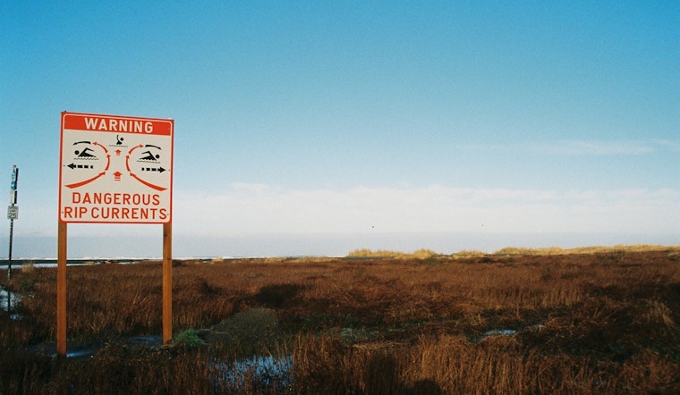
The Coastal Flood Advisory by the NWS detailed the risks, stating "Rip currents can sweep even the best swimmers away from shore into deeper water." They recommend that individuals caught in a rip current should relax and float instead of swimming against the current. If possible, swimming parallel to the shoreline could aid in escaping the current. In more dire circumstances, attracting attention from the shore is the advised course of action for those unable to reach safety unaided.
Further weather details and updates are available on the National Weather Service's website, which provides comprehensive information on the ongoing conditions and the week's forecast. The forecast calls for sunny days ahead, with high temperatures hovering in the mid-80s, though the chance of showers and thunderstorms will increase as the week progresses.


