Residents along the Southeast Georgia and Northeast Florida coastlines are being advised to brace for minor coastal flooding and to be wary of dangerous rip currents, the National Weather Service in Jacksonville has warned. According to the NWS, the Coastal Flood Advisory is now in effect until 6 AM EDT Wednesday, while the High Rip Current Risk warning extends through late Wednesday night.
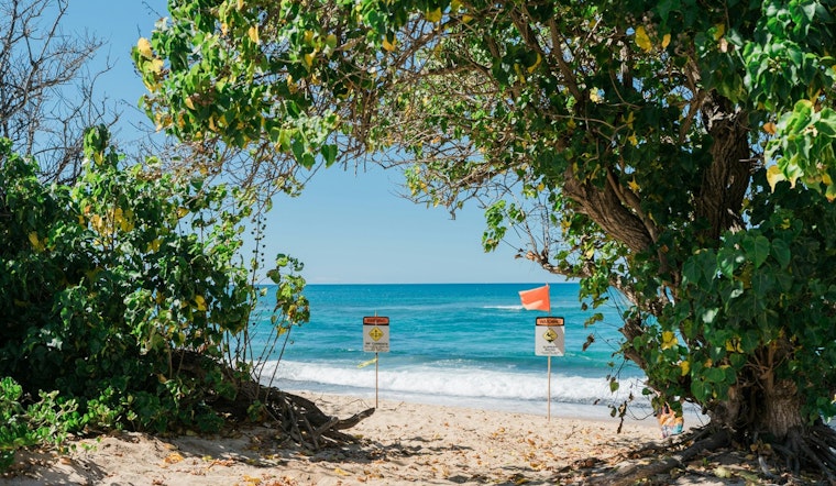
Specific areas impacted by these conditions include Coastal Nassau, Coastal Duval, Coastal Flagler, Northeast Coastal St. Johns, Southeast Coastal St. Johns in Florida, and Coastal Glynn and Coastal Camden in Georgia. The impact of the coastal flood is expected to be relatively minor, causing flooding of lots, parks, and roads with only isolated road closures anticipated. The rip currents, however, pose a significant threat, as they can "sweep even the best swimmers away from shore into deeper water," according to the Coastal Flood Advisory.
Weather forecasts for the region also suggest that showers and thunderstorms are likely, particularly before 1pm today, then again between 1pm and 2pm, and once more after 2pm, with new rainfall amounts of up to three quarters of an inch possible. The National Weather Service adds that breezy conditions with northeast winds of 9 to 17 mph, and gusts as high as 26 mph, may contribute to the higher than normal tides and increased risk of rip currents.
For those requiring travel in the affected areas, additional time should be allotted as some roads might be closed. Authorities stress not driving around barricades or through water of unknown depth, and recommend taking measures to protect flood-prone property. As for beachgoers, the National Weather Service advises swimming near lifeguards, and if caught in a rip current, to "relax and float," and not swim against the current.


