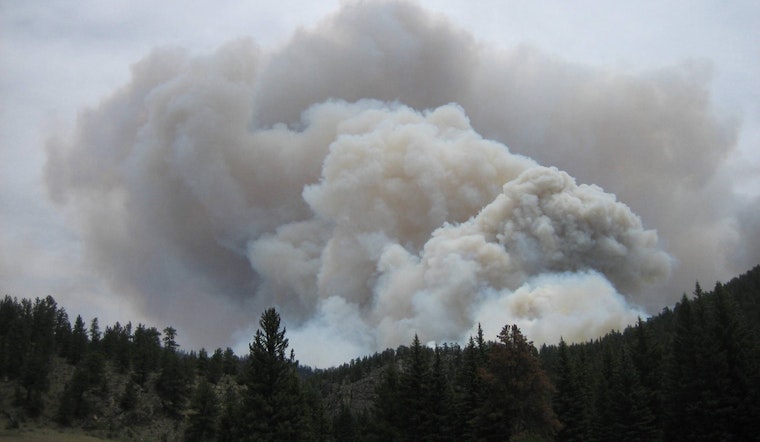
Las Vegas is grappling with more than its usual share of heat and dazzle as smoke from nearby wildfires blankets the city, pushing air quality to unhealthy levels. The National Weather Service in Las Vegas, in an early morning report, cautioned residents, especially in the northern Owens Valley, of persistent dense smoke that could continue into the evenings of subsequent days. The forecast stated visibility at the Bishop Airport has ranged between 1-2 miles throughout the night and air quality sensors showed poor conditions in the area.
The culprit, the Garnet Fire, has been dictating the ebb and flow of air quality, and per NWS, these conditions are likely to persist through the morning hours. Forecasts predict that the arrival of a Pacific trough later in the week could usher in cooler, drier, and windier weather, possibly providing some much-needed relief from the smoke. However, stability in the air is contingent upon the behavior of the ongoing wildfire.
Clear blue skies remain elusive for aviation, as dense smoke continues to produce less than ideal flying conditions. At Harry Reid International Airport, the 12Z Forecast Package from the NWS Las Vegas indicates southwesterly winds prevailing through much of the forecast period, with gusts ranging from 20 to 25 KT expected through early evening. Nevertheless, the overall forecast remains VFR, with temperatures holding just under 100 degrees.
Local spotters remain on high alert as the NWS encourages reporting of any significant weather events or impacts. For the rest of southern Nevada, northwest Arizona, and southeast California, winds should ease up overnight, predictably after sunset. But for those traversing central and northern Inyo County, smoke from the fires continues to plague visibility. The NWS report advises travelers to anticipate MVFR/IFR conditions due to smoke this morning until gusty up-valley winds develop this afternoon.


