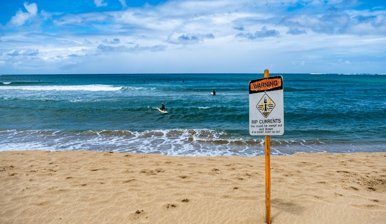
The National Weather Service in Jacksonville, FL has issued a rip current statement, warning beachgoers of dangerous surf conditions. The high risk for rip currents is now in effect through late tonight for Northeast Florida beaches, including Coastal Nassau, Coastal Duval, Coastal Flagler, Northeast Coastal St. Johns, and Southeast Coastal St. Johns areas. According to the Rip Current Statement by the NWS, "dangerous rip currents" are the primary concern.
Visitors are strictly advised to swim near lifeguards and to follow safety precautions when encountering a rip current. The NWS' Rip Current Statement suggests, "If caught in a rip current, relax and float. Don`t swim against the current. If able, swim in a direction following the shoreline." Those who cannot escape should not panic but instead face the shore and signal for help. The risk of rip currents will persist until the warning expires late tonight.
In addition to the coastal hazard, the weather forecast for Jacksonville shows sunny days ahead with moderate temperatures. Today's high is expected to reach near 68 degrees Fahrenheit with winds potentially gusting as high as 26 mph. A more placid weather pattern will settle in over the following days, with sunny conditions and highs in the upper 60s to low 70s. Nighttime temperatures will stay in the upper 40s to mid-50s throughout the week, as per the NWS.
The NWS has not only focused on the coastal hazards, but also provides a detailed forecast for the next several days. Friday is anticipated to be sunny, with a high near 69 degrees and a northwest wind around 8 mph. The weekend holds steady with clear skies and temperature highs ranging from 71 to 73 degrees Fahrenheit. Though sunny days are expected, the NWS also hints at "a 20 percent chance of showers and thunderstorms" by Sunday night which, could offer a temporary respite to the sunny streak.


