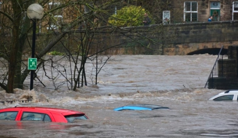
Residents of New Orleans and nearby areas experienced severe weather on Sunday, prompting multiple alerts from the National Weather Service (NWS), including a tornado watch and flash flood warnings across several parishes. Thunderstorms brought heavy rainfall, possible tornadoes, funnel clouds, and flash flooding, disrupting daily activities and creating hazardous conditions.
Throughout Sunday morning, the National Weather Service forecast thunderstorms produced between half an inch and three-quarters of an inch of new rainfall.
The National Weather Service issued a tornado watch until noon for nine parishes in Southeast Louisiana and five in Southern Mississippi, including Jefferson, Orleans, and St. Tammany in Louisiana, and Hancock and Harrison in Mississippi. Forecasters also called for additional showers and thunderstorms after 4 p.m., with south winds around 10 mph.
A Special Weather Statement warned of a strong thunderstorm over Timberlane capable of producing funnel clouds and wind gusts over 40 mph. The storm moved northeast at 35 mph, affecting areas including Chalmette, Marrero, and parts of Interstate 10.
Heavy rain led to flash flooding in small creeks, streams, and urban areas, prompting flash flood warnings. The National Weather Service cautioned that flooding of streets, highways, and low-lying areas was likely and urged motorists to avoid flooded roads. A broader Flood Warning remained in effect until 10 a.m. CDT, highlighting the risk of overflowing rivers and drainage systems.
A Flood Advisory also remained in place, warning of minor flooding in low-lying and poor drainage areas, with an additional 1 to 2 inches of rainfall possible. Authorities advised continued caution as flood risks persisted across the New Orleans area and surrounding communities.


