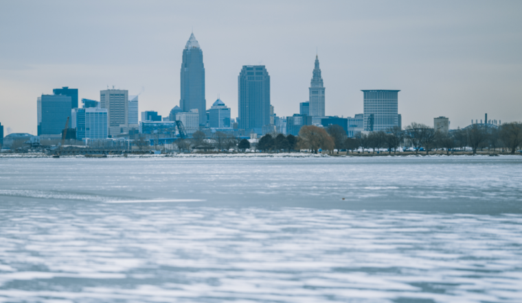
As a chill grips the Great Lakes region, Cleveland and its surrounding areas are bracing for the coldest weather of the season, according to the National Weather Service (NWS) in Cleveland. An upper-level trough, deepening and pushing towards the east, will usher in a spate of lake effect snow slated to impact the region through late Tuesday. Behind a departing surface low making its way into eastern Canada, there has been strong, cold air advection from the north moving across the lakes, the National Weather Service predicts, leading to wintry conditions and travel advisories.
The lake effect snow isn't just a fluke—it's a relentless spell set to potentially disrupt commutes and day-to-day activities. Underneath the trough's influence, a couple of periods of lake effect snow are certain to make their mark, especially in northeastern Ohio and northwestern Pennsylvania, according to the NWS discussion. While drier air may temporarily curb snowfall amounts, the Service advises residents to be prepared for quickly changing weather patterns and reduced visibility on roads.
What does this mean for temperatures? The region is to feel the sting of the season's lowest mercury levels thus far. Morning lows on Monday will be down into the mid-20s and only reach up into the mid-30s throughout the day, the NWS reports. The forecast for Tuesday morning is even more frigid, with lows expected in the low 20s and upper teens, accompanied by brisk wind chills likely to fall into the low teens.
Looking ahead, conditions are set to slightly improve as the workweek progresses. A weak ridge forecasted to build into the region may begin to pivot winds to a more westerly direction, which could gradually push lake effect bands away from shores and mitigate snow totals after Tuesday morning. The NWS suggests a warmer pattern, with precipitation possibly transitioning to rain by Wednesday. Temperatures are projected to rise into the upper 40s during the day, a modest reprieve from the early-week freeze.
Meanwhile, mariners navigating Lake Erie are advised to exercise caution. Strong northwesterly winds, gusting up to 30-35 knots, coupled with wave heights peaking at 8-12ft east of the islands, have necessitated the issuance of a Small Craft Advisory. By week's end, lighter winds and smaller waves are expected as high pressure settles in, signaling a potential break in the tumultuous conditions observed earlier in the week.


.jpg)