The aftermath of Oregon's wildfires continues to challenge the state with a secondary threat: increased flood and debris flow risks associated with burn scars. As reported by the Oregon Department of Emergency Management, these burned areas, where the vegetation has been removed, change the soil's ability to absorb water, and that could result in significant surface runoff during rain events, especially in steep terrains or poorly recovered vegetation zones.
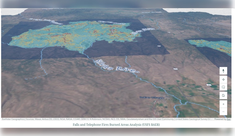
Regions across Oregon have been grappling with these issues, some more recently than others. In early 2021, following the Beachie Creek and Lionshead fires, the Santiam Canyon was hit with debris flows near Mill City and Gates. Wrapped in a winter blanket, the city of Burns in Harney County found itself overwhelmed by flooding along the Silvies River in the aftermath of the 2024 Fires. March 2025 made history in Douglas County when the Deer Creek at Roseburg crested to unprecedented levels, attributed, as many believe, to the burn scars in the Umpqua National Forest.
Flood risk intensifies in these post-wildfire landscapes because of their reduced capacity to infiltrate water and increased chances for erosion. The Oregon Department of Emergency Management cautions that such conditions may persist for years, relative to the fire's severity and how quickly the native vegetation can reclaim the soil.
In response, agencies including the Oregon Department of Land Conservation (DLCD), US Geological Survey (USGS), and others are engaging with local partners to improve flood risk assessments. With debris flow hazard maps and hydrologic models, these collaborations aim to better predict and prepare for emergencies arising from these vulnerable areas. Residents are urged to stay vigilant, keeping informed through services like ORAlert.gov, and to be versed in evacuation procedures—wisdom that cannot be understated, living beside a burn scar.
Looking ahead, as wildfires continue to shape and scar Oregon's landscapes, the connection between these burn scars and flooding grows ever more crucial for community safety and resilience. It is only through sustained scientific inquiry, sound emergency management, and dedicated local government cooperation can the state can hope to navigate this ongoing natural challenge.
For a deeper dive into the current situation and how burn scars contributed to the March 2025 flooding, the Oregon Department of Emergency Management has provided a March 2025 Story Map detailing the events and the response. To learn more, visit their website.


