The National Weather Service in Cleveland is advising residents to brace for an active bout of wintry weather. According to the National Weather Service, low pressure moving through the northern Great Lakes will usher in a mix of snow, cold temperatures, and brisk winds. Accumulating snow is expected in northwest Pennsylvania tonight until tomorrow, while the rest of the area should feel a significant shift between rain and snow, depending on location and timing.
Cleveland will witness "light widespread snow across the northern half of the area today," eventually giving way to what could be an intense snow band around northwest Pennsylvania in the pre-dawn hours of Wednesday. This is due to "strong lift from the incoming upper trough and support from the left exit region of the upper jet," as reported by the NWS. Consequently, there's a Winter Weather Advisory in effect for Southern Erie and Crawford Counties in PA from 1 AM to 10 PM tomorrow. Enhanced wind gusts, potentially reaching 40 to 45 mph, are expected to precede a frigid cold front that plunges temperatures back to wintry levels.
In anticipation of the unsettled conditions, the impact on aviation is set to be significant. In a recent update from NWS Cleveland, the region starts with VFR but anticipates "lower end MVFR to IFR from west to east overnight." Snow and a rain mix will impede visibility and potentially result in hazardous travel conditions.
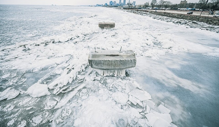
Marine conditions on Lake Erie are also gearing up to be particularly rough, with Small Craft Advisories already in place and Gale Warnings on the horizon from late tonight through Wednesday evening. Expect "southwesterly winds will increase 35 to 40 knot Gales late tonight and Wednesday," and wave heights could surge between 8 to 13 feet according to NWS. Boaters and lakeshore residents should exercise caution and stay updated on any marine advisories, given these potentially hazardous conditions.
As we head into the weekend, NWS Cleveland does not predict any letup, with further cold temperatures and lake effect snow likely for northeast Ohio and northwest Pennsylvania. The onslaught of winter weather seems relentless, with a strong possibility of "temperatures returning to the teens/20s for highs and lows in the single digits/teens." Residents, particularly those in the mentioned areas, should remain vigilant, prepared for rapid changes in conditions and ongoing winter weather challenges.


.jpg)