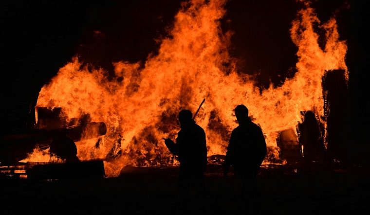
A late-night wildfire flared up yesterday in eastern Madera County near the Friant area, first reported around 10:11 p.m. on private land under the name Fine Gold Dr / Ralston Rdg in national incident feeds. Early notes did not include a cause or any containment estimate, and local fire crews were dispatched while residents in nearby foothill communities were urged to keep a close eye on official alerts.
The Sacramento Bee was the first outlet to flag the listing in federal tracking systems, which provided the initial public heads-up but only bare-bones details. The Bee item, credited to a CA Wildfire Bot newsroom template, pulled straight from national incident feeds for its core information on the blaze.
What the incident feeds show
The fire also appears in federal reports maintained by the National Interagency Fire Center, which aggregates incident data that local agencies and newsrooms rely on. CAL FIRE's incidents page notes that many smaller fires, especially ones under 10 acres, might not show up on the state site right away while crews firm up acreage and containment figures, so public details can be thin in the opening hours.
That kind of lag is standard during initial attack operations, when incident commanders are still getting a handle on fire behavior, access routes, and risks to people and property. In other words, the first official listing often arrives long before the fuller story does.
What residents should do
Early reports did not list any evacuation orders or injuries, according to The Sacramento Bee. Even so, residents in Friant and surrounding foothill neighborhoods are being urged to stay plugged into updates from the Madera County Sheriff's Office and other local emergency channels and to be ready to follow directions from law enforcement if conditions shift.
County alert systems, CAL FIRE's incident map, and the federal feeds used by the National Interagency Fire Center remain the key places to watch for changes in containment or any evacuation guidance.
Why this matters
The incident pops up at a time when large wildfires are relatively quiet nationwide, but the National Interagency Fire Center's situation report has flagged a series of atmospheric rivers expected to move into California later this week. That kind of storm pattern can quickly rewrite the playbook for firefighters.
Heavy rain can slow a fire's spread, yet it can also turn roads into mud, limit access, and complicate mop-up work, so conditions on the line can change in a hurry as crews adjust to shifting weather and hazards. This story will be updated when agencies release confirmed acreage, containment figures, and any evacuation notices.


