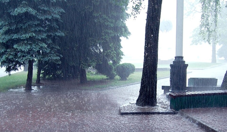
The Pacific Northwest is bracing for the one-two punch of an unforgiving atmospheric river and powerful wind gusts, as the National Weather Service in Seattle issues a string of advisories for heavy rain and strong winds potentially leading to flooding, power outages, and increased landslide risk. A Flood Watch remains in effect through Friday afternoon for areas including Clallam, King, and Pierce counties, with the NWS warning of "excessive rainfall" that could overflow rivers and flood urban regions.
Simultaneously, the NWS has extended a Wind Advisory warning the public of south winds traveling 20 to 30 mph, with gusts to potentially reach up to 40 mph. Expected to hold from 7 AM to 10 PM PST today, these winds threaten to casually scatter unsecured objects, bring down tree limbs, and to possibly disrupt power lines. Forecasters are stressing the need for heightened caution, particularly when driving high profile vehicles and securing outdoor belongings.
Residents are also on alert for landslides with recent and forecasted rains primed to saturate soils to critical levels. A Special Weather Statement released by the NWS notes "antecedent soil moisture to high levels" and that the expected rainfall will put extra pressure on soil instability. This warning is especially acute for areas with steep slopes, including coastal bluffs and road cuts as well as regions impacted by recent wildfires, where the ground is particularly vulnerable to rapid and dangerous movements.
Forecasters are advising the public to stay updated on the latest weather conditions, to prepare "to take action should flooding" develop, and to remain vigilant of surroundings, particularly near slopes and previously burned areas. With the potential to cause significant disruption, it is critical that community members adhere to precautions and respect the powerful forces of nature at play.


