On California’s worst fire days, the real threat is not a single wall of flame but dozens of scattered lightning strikes quietly building toward one monster event. Researchers at Lawrence Livermore National Laboratory (LLNL) and UC Irvine say they have built a simulation that can forecast when those separate lightning‑started blazes are likely to merge into a single, fast‑moving fire complex.
The model is designed to mimic how flames interact with local winds and the atmosphere, including fire‑spawned thunderstorms that can whip up new ignitions miles away. Scientists say that if incident commanders can anticipate those multi‑front pileups in advance, it could change where they stage crews and aircraft on the worst days of fire season.
Study Finds Outsized Role For Multi‑Ignition Fires
A peer‑reviewed study finds that so‑called multi‑ignition complexes, meaning fires that start as several nearby blazes and later merge, punch far above their weight in California’s fire statistics. According to Science Advances, these events made up roughly 7% of the state’s fires between 2012 and 2023 but accounted for about 31% of the area burned.
The same analysis links fire mergers to faster spread, longer duration and more intense pyrocumulonimbus activity than single‑ignition fires, which helps explain why they so often end up in the “historic” and “record‑setting” categories.
How The Model Works
The team stitched together UC Irvine’s satellite‑based fire tracking with LLNL’s high‑resolution climate modeling, tapping the Department of Energy’s E3SM system, to see how multiple ignitions play off winds, moisture and each other.
As Lawrence Livermore explains, the framework explicitly simulates pyrocumulonimbus development and its downstream effects, including the potential for lightning that triggers new fires far from the original perimeter. The lab stresses that the system is still firmly in the research phase and is not yet an operational forecasting tool.
What Firefighters Say
On the fire line, the appeal is obvious. Oakland Fire Department Assistant Chief Christopher Foley told The Mercury News that more accurate forecasts for multi‑front events could help incident commanders make smarter calls about where to send crews and aircraft during chaotic fire days.
Foley noted that multiple, scattered ignitions strain limited resources and increase the risk that firefighters can get boxed in by shifting fronts if those separate fires suddenly hook up.
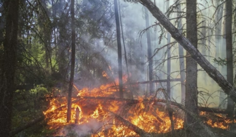
A Recent Example: August 2020
Dry‑lightning storms in mid‑August 2020 lit up Northern California, starting dozens of fires that later fused into massive complexes. The August Complex alone ultimately burned roughly 1,032,648 acres, according to Cal Fire, a stark reminder of how a cluster of separate starts can morph into a single, record‑setting blaze.
What’s Next
LLNL researchers say they plan to sharpen and validate their simulations with observational data from a planned 2026 NASA field campaign, then test whether the model’s output can be used for energy‑infrastructure resilience planning, according to the lab’s release.
Turning that work into real‑time wildfire forecasting will require denser observations, live data assimilation and buy‑in from fire agencies before the tool can influence how officials dispatch resources or issue evacuation orders.
Why The Clouds Matter
When a large fire builds a pyrocumulonimbus cloud, essentially a fire‑fueled thunderstorm, it can loft smoke and embers into the upper troposphere or lower stratosphere and spin up lightning that ignites fresh fires far from the original blaze.
Observations and modeling have placed these pyroCb injections at roughly 14 to 16 kilometers in altitude, or even higher, which helps explain how a handful of clustered ignitions can suddenly escalate into a single extreme event, according to research published in Atmospheric Chemistry and Physics.
For Bay Area residents and planners, the practical takeaway is that knowing when many small fires are about to converge could be just as important as predicting any one megafire. For now, the promise is mostly scientific: the next steps are field campaigns, agency trials and hard proof that this model can lead to better decisions on the ground.


