Knoxville woke up to a cold, murky mess on Saturday morning, January 31, 2026, with dense fog and on-and-off snow showers making it feel every bit like midwinter. Temperatures are stuck in the upper teens, around 18°F at local stations, and visibility has dropped to roughly 1.3 miles in spots. A Winter Storm Warning and a Cold Weather Advisory are in effect across the region, so residents should plan on accumulating snow and stinging wind chills through the day.
What To Expect Today
Snow showers will be most common through the morning and into the afternoon, with the daytime high only reaching around 22°F. Across the valley, new snow accumulations of 1 to 3 inches are possible, while the foothills and areas near the Smokies could see higher totals of 3 to 6 inches or more where heavier bands have set up. The chance of precipitation is around 80% this morning, and the latest warning details are posted by the NWS Morristown.
Afternoon Winds Pick Up
By afternoon, north winds are expected to increase to 10-15 mph with gusts up to 25 mph, which will make the already cold air feel significantly worse. Wind chill values could drop to around 2°F in the valley, with even more punishing chills across higher terrain. Layer up, cover exposed skin, and keep outdoor time to a minimum if you can.
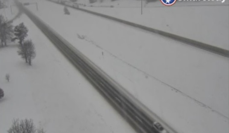
Travel And Safety
Travel is the main headache today. Snow-covered roads, paired with those gusty winds, will lead to slick and potentially hazardous conditions. State officials are urging drivers to skip nonessential trips and to check road and traffic updates at Tennessee 511 or by dialing 511. If you have to be out, give plows and salt trucks plenty of room, slow down, and plan for extra travel time.
Weekend Outlook
High pressure builds in on Sunday, February 1, 2026, bringing back mostly sunny skies and a daytime high near 29°F, although nights will stay very cold. A gradual warmup follows next week, with highs near 39°F on Monday, February 2, 2026, and climbing into the upper 40s by Tuesday afternoon, February 3, 2026, along with a slight chance of rain late Tuesday. More details are available from NWS Morristown.
Preparedness Tips
If the power goes out, run generators only outdoors and well away from windows and vents, and check in on elderly neighbors and pets to make sure they are staying warm. If you must travel, keep an emergency kit in your vehicle with water, snacks, warm clothing, and a small shovel so you are not caught off guard by the winter roads.


