The National Weather Service in Cleveland has issued an update regarding the ongoing weather situation affecting Northeast Ohio and Northwest Pennsylvania. According to NWS their latest Area Forecast Discussion, the probability of precipitation (PoPs), Quantitative Precipitation Forecast (QPF), and snow amounts have seen a slight increase through Thursday evening. Areas downwind of Lake Erie are expected to see no more than 1 to 2 inches of snow over the next couple of days.
In light of the inclement weather, a Cold Weather Advisory has been issued for portions of north central, northeast, and northwest Ohio. It's set to take effect from 7 PM this evening to 11 AM Thursday. With lower confidence compared to previous advisories, this notice is primarily due to a slightly warmer airmass and the potential for lake effect clouds to maintain higher than forecasted temperatures. Nonetheless, the advisory has been widely issued, in part due to extended cold conditions that elevate risks to the vulnerable and infrastructure. The NWS warns of serious exposure risks alongside issues like burst pipes, water main breaks, and dead batteries persisting at least through Monday.
Central to this week's weather narrative is the prolonged bout of cold weather sweeping the area, expected to plunge wind chills down to around -15 across most of the forecast area. The cold spell is projected to continue through the weekend, which may include record low temperatures, igniting concerns over increased cold exposure and potential damage to infrastructure. The coldest temperatures are anticipated Thursday night into Friday morning, and again Friday night into Saturday morning, with lows ranging between -5 to -10 degrees.
Additionally, the forecast underscores the possibility of snow – due to an upper-level trough covering much of the Eastern U.S., producing periodic light snow showers. Although Lake Erie is significantly ice-covered, minor snow accumulations are expected intermittently this week. For aviation purposes, periods of MVFR conditions are likely, with the more frequent VFR forecasted for Northwest Ohio, yet more persistent MVFR expected farther east.
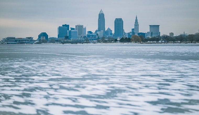
On the marine front, Lake Erie is poised to see winds turn southwest and rise up to 15-20 knots throughout the day as another cold front nears. The ice on the lake is forecasted to thicken and expand, which will keep it stationary despite shifting wind directions and speeds. Meanwhile, record low temperatures are on the horizon for Friday and Saturday, challenging historical lows set in previous years for cities in Ohio and Pennsylvania.


.jpg)