Bundling up is not just a fashion statement for Clevelanders. As the cold snap continues, residents brace for more frigid days and the growing chance of significant snowfall. The latest report from the National Weather Service in Cleveland confirms a persistent freeze with temperatures dipping below 20 degrees tonight, and wind chills could make it feel as low as 10 degrees below zero this morning. This cold streak is no short-term guest, forecaster's notes warn of risks associated with prolonged exposure, including frostbite, saying, "the persistent cold will continue to produce similar impacts on infrastructure, people, and animals through today at the very least."
Travelers might grapple with more than just icy conditions. As the NWS discussion details, "Light snow chances remain possible on Monday, which could produce some marginal travel impacts." Residents might sigh with relief, knowing that a slight thaw is on the horizon with temperatures venturing into the low to mid-20s on Monday. Still, such a short-lived warmth will barely touch the deep freeze that Cleveland has experienced over the last nine days.
Looking ahead, the forecast becomes a mix of hope and uncertainty. There's a potential storm brewing late in the week, which could bring widespread snowfall. However, meteorologists say it's too early to nail down the specifics. According to the NWS's latest updates, "An area of low pressure is progged to push southeast from the Northern Plains into the Great Lakes region near the end of this week." But with the "exact track and evolution of the system" still up in the air, snowfall amounts and timing remain a guessing game for now.
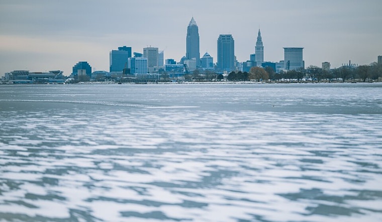
As for Cleveland's skies, aviators can expect generally clear paths with VFR visibility anticipated through the upcoming TAF period. That said, the weather service hints at challenges, mentioning, "Periodic non-VFR due to low clouds and/or snow expected through this Thursday." Mariners are not left out of the equation – with continued cold temperatures and relatively tame winds, the icy grip on Lake Erie is set to strengthen even further through Thursday. Concluding the discussion, the NWS shared, "The continued presence of a cold air mass and the relatively weak winds will allow extensive ice cover on Lake Erie to expand and thicken further through Thursday."


.jpg)