Cleveland wakes up to clear skies and crisp air on Tuesday, February 10, 2026, with temperatures hovering near 30°F this morning. A milder push of air should bump afternoon highs into the low 40s, and there is a slight chance of a light shower late in the day, so it is not a bad idea to keep an umbrella close. For folks along the lakeshore, though, the bigger headline is shifting ice and on-and-off lake-effect snow showers from later Tuesday night into early Thursday.
Afternoon Rain Chance And Tonight's Snow
Skies stay partly sunny Tuesday with a high near 42°F and a slight chance of light rain between 3 and 4 p.m., which could briefly dampen roads during the afternoon commute. Southwest winds of 9 to 13 mph will swing around to the west behind a front, with gusts possibly reaching the mid to upper 20s mph in spots. According to the National Weather Service Cleveland, lake-effect snow showers become likely after 1 a.m. Tuesday night, with the heaviest snow focused in the usual snowbelt zones of northwest Pennsylvania and northeast Ohio.
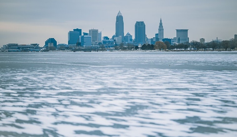
Lake Ice And Shore Safety
Lake Erie remains largely ice covered, and the combination of milder temperatures and shifting winds boosts the risk that ice floes could crack, break away, and drift toward shore. Anglers and beachgoers are urged to go easy and double-check conditions before heading out. Cleveland Metroparks continues to recommend confirming ice thickness and steering clear of uncertain ice near harbors and inlets. Keeping a safe distance from the waterline this week is a smart move until the ice stabilizes again.
Late Week Outlook
High pressure builds in later this week, nudging temperatures back toward seasonal norms. Highs should land near 29°F on Thursday, around 34°F on Friday, and into the mid 30s by the weekend. Winds are expected to ease from late Wednesday into Thursday, which should improve travel and cut down the risk of shoreline ice movement. Travelers and anyone planning shoreline activities should keep an eye on updates from the National Weather Service as the week plays out.


.jpg)