As of 5:40 a.m. today, Cleveland woke to cloudy skies, a mid‑20s chill, and the kind of spotty flurries that dust windshields but rarely ruin plans. Light snow showers and flurries are possible through midmorning, yet most neighborhoods are only in line for a light coating with minimal impact on travel.
Afternoon And Tonight
Through the day, temperatures are expected to top out near 28°F with a northwest breeze of about 8 to 12 mph. There is roughly a 20% chance of light snow showers before early afternoon, with most spots seeing no more than a trace to a dusting of accumulation and only minor effects on roads, according to the National Weather Service Cleveland.
Weekend Warm‑Up
High pressure builds in on Friday and starts a quick rebound from the morning chill. Highs climb into the low 40s on Saturday and stay in the 40s into next week, with the warmer stretch continuing into Tuesday and Wednesday. That bump in temperatures will chew through much of the recent snowpack and help clear streets and sidewalks, although the melting can leave behind slushy spots and standing water, especially in low‑lying areas.
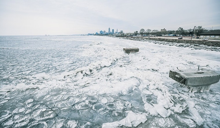
Rivers And Ice
The forecast discussion notes that rapid snowmelt, combined with remaining river ice, could lead to gradual rises and isolated ice jams on smaller streams next week. As outlined in the NWS area forecast discussion, Lake Erie remains largely ice-covered, and any loose ice can shift with changing winds. Shoreline and riverfront residents are advised to stay alert to rising flows.
Commute And Plans
Today’s commute should be mostly manageable, with just enough wintry mix to justify leaving a little early. Drivers should allow a few extra minutes and watch for slick patches on untreated or shaded roads. For weekend plans, the afternoon is the sweet spot, as temperatures in the 40s should leave many sidewalks and bike paths slushy or even mostly bare.


.jpg)