Saturday, February 28, 2026: Orlando woke up under a gray blanket of patchy fog and mist this morning, with temperatures hanging near 65°F at local observing stations and visibility trimmed to roughly six miles. Low clouds and spotty wet roads may slow early commutes, so drivers should build in extra time and flip on their headlights in any reduced-visibility stretches.
Afternoon Storms Possible
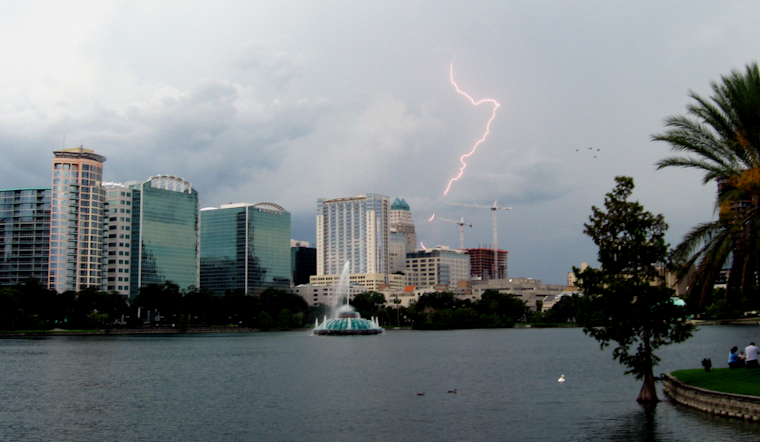
A slow-moving front will slip south across the region today, bringing about a 50% chance of showers and thunderstorms from late morning into the afternoon. Highs should top out near 74°F before slipping into the low 70s by late afternoon. New rainfall amounts of a quarter to a half inch are possible, with brief heavy downpours where storms fire up. A few storms, mainly from central Osceola and southern Brevard counties down toward Lake Okeechobee and the Treasure Coast, could pack lightning, gusts up to 40–50 mph, and small hail. A Marginal Risk exists for a couple of stronger storms, according to the National Weather Service in Melbourne.
Foggy Commute; What To Expect
Low clouds and pockets of dense fog this morning are likely to cut visibility at times and could briefly affect flights and surface travel. Conditions should gradually improve, with most locations seeing better visibility by Saturday evening. Earlier this week, forecasters flagged gusty winds and a short Red Flag period across parts of east-central Florida; see our coverage of gusty winds and a short Red Flag period for background.
Boaters and Beachgoers: Next Week
Onshore easterly winds are forecast to strengthen Monday into Tuesday, turning conditions breezy along the coast and pushing seas higher. The National Weather Service in Melbourne cautions that persistent easterly winds will build seas to around 6–9 feet by Tuesday near the Gulf Stream, so recreational boaters and small-craft operators should be ready for poor to hazardous conditions and check local marine forecasts before heading out.
Bottom line: expect a foggy, muggy start to Saturday with a solid chance of showers and scattered thunderstorms by midday. If a storm heads for your neighborhood, move indoors and stay off open water. We will update this page if watches or warnings are issued, so check local forecasts and radar before you go.


