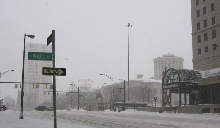
Residents across Ohio, Kentucky, and Indiana are facing a week of frigid temperatures and multiple rounds of snow, according to the latest forecast from the National Weather Service in Wilmington. The advisory, which remained in effect until 10 AM EST this morning, extended through areas covered by the National Weather Service, including Columbus, Cincinnati, and beyond. The service indicated "Frigid temperatures will continue through this weekend and below normal temperatures expected all week."
The immediate forecast does not offer much in the way of relief. A cold weather advisory has been continued "for the overnight hours and through the morning daytime hours on Sunday," and there is a potential need for another advisory Sunday night, especially in central Ohio. As the week progresses, the NWS is preparing residents to not only brace for the cold but also watch out for several systems that are set to bring snow to the region. A system poised for Monday might likely bring light snow, mostly north of Interstate 70, while another on Tuesday is expected to focus primarily south of that highway, with accumulation up to two inches possible around the Ohio River.
As these systems move in, a clipper system arriving later in the week is anticipated to not only introduce fresh snowfall but also a "reinforcing shot of cold air as well bringing single digit low temperatures back into the picture," along with gusty winds. The NWS was clear in their discussion that these types of systems "often are over performers with snow amounts," signaling that forecasted figures might be subject to upward revisions depending on the system's exact trajectory.
Aviation conditions aren't looking much better. The NWS has reported that MVFR clouds are moving out, and while some clear skies today may offer a temporary respite, the next system's approach tonight means that additional clouds will obscure skies by evening. Though forecasters could not confidently predict visibilities lower than MVFR owing to "some uncertainty with cloud cover," the potential for fog overnight was acknowledged. Pilots are advised to anticipate the likely occurrence of MVFR CIGs, with chances of MVFR VSBYs and even IFR CIGs in the early part of the week, shifting to possible IFR conditions both in ceilings and visibilities Tuesday into Tuesday night.
With such conditions on the horizon, the community is encouraged to stay tuned to updates and prepare for a week that will test their resilience to wintry weather. For more detailed information, the National Weather Service encourages individuals to visit their website.


