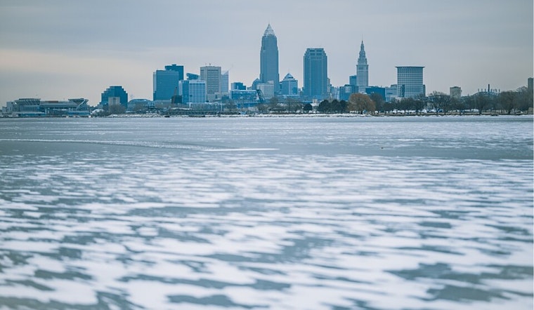
The National Weather Service in Cleveland has brought a bit of hope for those in Ohio weary of the chill, with a forecast that predicts temperatures will finally climb above freezing on Tuesday. The region has endured a frosty barrier for over two weeks, and residents are eagerly anticipating the thaw. According to the recent NWS Area Forecast Discussion, "Still on track to be above freezing Tuesday for the first time in over a couple of weeks for most in our CWA."
Despite the warm front expected to grace the area, the respite will be short-lived as lake effect snow and cold air are set to make a comeback Tuesday evening into Wednesday night. Lake Erie, while mostly ice-covered, won’t be enough to stop the snow showers that could pepper the snowbelt areas following a cold front. Those hoping to fully shake off winter's hold might have to wait just a bit longer, with the forecast indicating that "light lake effect snow showers in the wake of the cold front will be possible, aided by saturated low levels and cold air advection occurring as well."
The forecast does bring a consistent note of balmy relief, with temperatures expected to stabilize closer to the seasonal norm by the week's end, extending into the next weekend. This news provides some comfort to those weary from the relentless grip of cold. The NWS report shares, "Not as cold/closer to normal temperatures for this time of year for the end of the week through the next weekend."
Aviation reports from the same source maintain a positive outlook with continuing VFR (Visual Flight Rules) conditions through the current TAF (Terminal Aerodrome Forecast) period. Skies will generally remain clear, transitioning to VFR ceilings above 5,000 feet in the afternoon. However, pilots should be alert for non-VFR possibilities in snow showers expected to hit the northeast Ohio and northwest Pennsylvania regions Tuesday night into Wednesday.
Regarding Lake Erie's maritime conditions, nearly complete ice coverage is the current status, and winds are forecasted to primarily hover out of the east-southeast at tame speeds under 10 knots through to tonight. It's anticipated that the lake ice, especially east of the Lake Erie Islands, will be prone to some movement this week as winds shift and pick up pace post-cold front.
No watches, warnings, or advisories are currently in effect, save for a Cold Weather Advisory in Pennsylvania, which remains until 10 AM EST today. With the community poised for a brief touch of warmth, the anchor of the ice and cold spells a paused but persistent reality for the Great Lakes as winter continues its dominance.


.jpg)