San Jose drivers are waking up to mostly cloudy skies and about 54°F at Mineta San José International this morning, with the early commute under a steady rain. Showers are likely through mid-morning, and forecasters are eyeing the early afternoon for the real action, with the best window for thunderstorms between roughly 1 PM and 4 PM today. The high should top out near 58°F before slipping back into the mid-40s tonight. Expect slick roads and brief bursts of heavy rain in the strongest cells, especially during school pick-up and the evening drive.
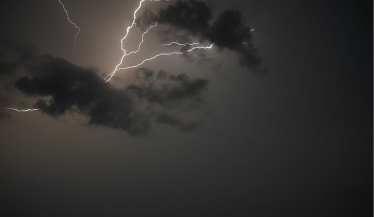
Afternoon Thunder Risk And Commute
According to the National Weather Service, showers will hang around this morning, with a slight chance of embedded thunderstorms developing this afternoon on Wednesday, February 11. Any storms that pop up could bring lightning, pea-sized hail, and brief heavy rainfall, which may cause localized ponding on streets and in low-lying areas. Winds will blow from the south southeast at 10 to 14 mph with gusts near 24 mph in town, so high-profile vehicles and cyclists should be on alert. Drivers should also be ready for sudden drops in visibility inside heavier cells and build in extra time for the evening commute.
Winds, Coastal Watches, And Marine Impacts
Coastal areas and exposed ridgelines will see the strongest gusts, and Small Craft Advisories plus a Gale Warning remain up for parts of Monterey Bay this morning, so mariners are urged to avoid exposed runs until seas settle down. A Central Coast rain rundown details local advisories and highlights that the Central Coast and nearby hills are lined up for the heaviest totals. If your home sits in a particularly exposed spot, secure loose outdoor items and be ready for brief, gusty, and erratic winds around the more intense showers.
Thursday And Weekend Outlook
Things should calm down on Thursday, February 12, with drier conditions, some patchy morning fog, and a high near 63°F before a relatively quiet stretch through Friday. Forecast models then bring in another unsettled system late Saturday, February 14, carrying additional rain chances and breezy conditions into the Valentine’s Day weekend. Forecasters say they are not expecting mainstem river flooding at this point, although rainfall totals will run higher over the coastal ranges and the Santa Cruz Mountains.
How To Prepare
On the roads, ease off the gas on wet pavement, give yourself extra travel time, and avoid driving through standing water. Check your transit agency or ride share alerts before heading out, and keep a light rain jacket handy if you have afternoon plans. If the weather takes a turn, follow real-time updates from city and county channels along with the National Weather Service.


