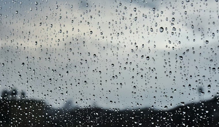
San Jose is waking up under a cool, mostly cloudy sky this morning, with temperatures hovering near 52°F at San Jose International Airport. The gray is not going anywhere fast. Rain is set to spread across the area today and hang around through the workweek, so plan on wet streets, windshield wipers on repeat, and occasional heavier downpours.
Rain Through Midweek
Showers and periods of steady rain will continue through midweek. Forecasters expect roughly 1 to 2 inches of rain from tonight until tomorrow across much of the South Bay, with another 0.5 to 0.75 inches possible on Tuesday. The Santa Cruz and Santa Lucia ranges could stack up 2 to 3 inches in total before this round is done.
High tides could add a little extra drama along the bayshore. Tides are expected late morning on three straight days: Sunday at 9:34 a.m., Monday at 10:16 a.m., and Tuesday at 10:58 a.m., which could push minor flooding onto bayfront streets and marina parking lots, according to the National Weather Service San Francisco.
Afternoon Winds And Coastal Flooding
On top of the rain, southerly winds will crank up this afternoon. Many neighborhoods can expect gusts in the 20 to 30 mph range, while the windiest coastal and ridge-top spots could see gusts up to about 45 mph. A Coastal Flood Advisory is in effect through Tuesday, so low-lying shoreline trails, waterfront parking areas, and some bayfront roads may see brief saltwater overruns during the high tide cycles.
For more local context and preparedness tips, check out our earlier breakdown of this forecast.
Commute Tips And Safety
Drivers should expect slick roads for the afternoon and evening commute today and again tomorrow morning. Give yourself extra time, ease off the gas, and keep headlights on whenever the rain is falling. Avoid driving through standing water, which can hide potholes or be deeper than it looks. If you live in an exposed or windy spot, secure or bring in loose outdoor items before the strongest gusts arrive. Transit riders should check VTA, Caltrain, and other operators for any service updates before heading out.
Looking Ahead
Later in the week, a colder and stronger system is poised to move in. Snow levels are expected to drop, and higher peaks could see a more noticeable coating of snow, while another round of gusty winds is possible. Officials may post Wind or Winter Weather Advisories if conditions ramp up, so it is worth keeping an eye on updated forecasts over the next few days.


