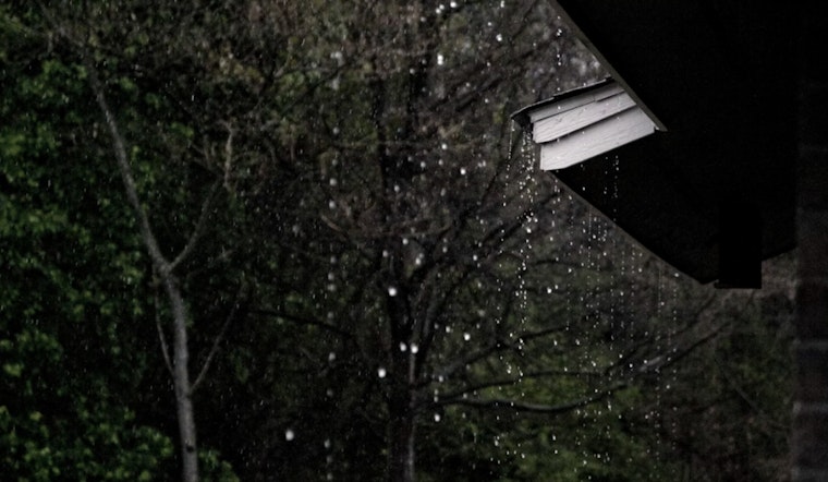
Sacramento rolled out of bed under a solid deck of clouds this morning, temperatures hovering near 46°F, and the real show is still on the way. A wet and windy stretch is moving into the Valley, with steady rain expected to arrive late tonight, then ramp up on Tuesday. A sharper band of showers and isolated thunderstorms is forecast between about 1 p.m. and 4 p.m. Tuesday, bringing a burst of heavier rain. Gusty southerly winds will make it feel colder and could briefly push gusts into the 30s across the city. Highs should only reach about 49°F, and slick roads are likely for the drive home.
Afternoon Commute: Showers, Thunder And Quick Downpours
Rain is expected to settle in before 1 p.m., then give way to rounds of heavier showers and thunderstorms through mid-afternoon. Some cells could drop intense, short-lived downpours that cut visibility and slow traffic in a hurry. In the Valley, the most active bands may deliver roughly one-half to three-quarters of an inch of rain, with pockets of higher totals, which is plenty to cause ponding on city streets and sluggish freeway merges. Temperatures should top out near 49°F, then slide through the afternoon as the front moves through. According to the National Weather Service Sacramento, the prime window for thunder is Tuesday afternoon.
Winds And Advisories
A Wind Advisory remains in effect through 10 p.m. Thursday, with south winds generally running 12 to 21 mph and Valley gusts at times in the 35 to 45 mph range. Around town, gusts near 30 to 32 mph are likely during the peak. Those bursts can shove around unsecured patio furniture, snap small branches and trigger isolated power outages, and high-profile vehicles will want to take it slow on exposed stretches of road. Forecasters expect a brief lull in the winds on Wednesday before another round of gusty conditions late Wednesday into Thursday. Secure loose items now and try to avoid unnecessary trips with high-profile vehicles when gusts kick up.
Mountain Travel And Road Conditions
The Sierra and nearby foothills are under a Winter Storm Warning through 10 p.m. Thursday, with heavy mountain snow and lowering snow levels that could make roads hazardous even below the highest passes. Caltrans is warning drivers to be ready for chain controls, slower travel and possible closures, and suggests that anyone thinking about a mountain trip should reconsider plans and check conditions before heading out. In the Valley, drivers should keep an eye out for flooded low spots and steer clear of standing or moving water. For up-to-the-minute information on closures and chain requirements, visit Caltrans District 3.
How To Prepare
Build in extra time for errands and commutes, slow down on wet pavement and keep headlights on, and never attempt to drive through flooded stretches of road. Tie down or bring in outdoor furniture, charge phones and keep flashlights handy in case the lights go out. If a mountain trip is unavoidable, carry chains, warm clothing and a full winter emergency kit, and check official advisories before you pull out of the driveway. Keep an ear on local alerts and updates from the National Weather Service for any changes to the forecast.


