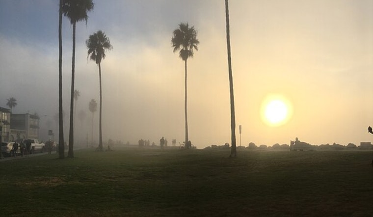
San Diego woke up under a gray blanket Friday, with fog hanging over the coast and San Diego International (KSAN) reporting mist, around 6 miles of visibility and a mild 63°F. The marine layer is expected to pull its usual disappearing act by late morning, clearing the way for mostly sunny skies and highs near 75°F across much of the city.
Morning Fog, Afternoon Sunshine
Patchy fog should lift by about 11 a.m., leaving mostly sunny conditions and light northwest winds around 0 to 10 mph. According to the National Weather Service San Diego, coastal spots will shake off the gloom first by midday, while inland neighborhoods warm into the mid 70s.
Weekend Warmth And Gusts
Saturday is set to crank up the heat a bit, with inland highs expected to top out near 80°F and northwest winds increasing to 5 to 15 mph with gusts up to 25 mph. Forecasters say several March temperature records are on the line, especially in the mountains and low deserts, as reported by Times of San Diego, so it is a good idea to time your outdoor plans for earlier or later in the day.
Next Week: Cooler With A Slight Chance Of Showers
The upper-level ridge weakens Sunday, which brings a modest cooldown and opens the door to a slight chance of rain Tuesday and Wednesday as onshore flow returns. The National Weather Service San Diego notes there is still uncertainty about the timing and track of that system, but any showers that do develop are expected to be light and focused over the mountains and coastal slopes.
What To Know For Your Commute
Early drivers should be ready for reduced visibility during the morning commute, using low-beam headlights and building in some extra time. If you are planning to be outside Saturday afternoon, secure loose items around patios or balconies and be prepared for gusty inland breezes.


