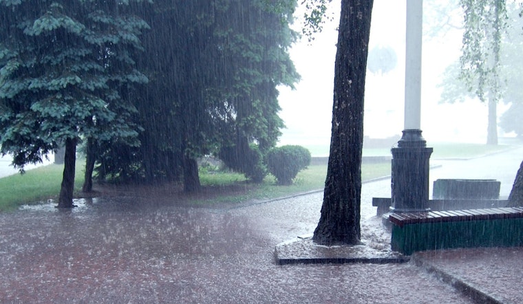
New Orleans woke up Friday to a sticky start, with mostly cloudy skies, muggy air and temperatures parked in the low 70s. Visibility dropped in spots near the lake as pockets of sea fog lingered over nearshore waters, with some of that murk threatening to drift inland around bridges and the lakefront. By midday, though, the city is expected to trade the haze for heat, with highs climbing to around 81°F and a chance of showers and thunderstorms popping up around lunchtime.
Morning Fog And Coastal Travel
A Dense Fog Advisory is in place for nearby coastal waters into mid-morning, and the sea fog could push onshore into the Mississippi Sound, Lake Borgne and northern Lake Pontchartrain. That could cut visibility on bridges and at marinas, making for a dicey start for anyone on the water. Small-craft operators are urged to hold off on nonessential trips, and drivers are advised to stick to low beams and build in extra time for the morning commute, according to the National Weather Service.
Afternoon Heat And Scattered Storms
By midday, some sun should finally break through, and temperatures are expected to top out near 81°F, with southeast winds around 5 to 15 mph. Forecasters are calling for a 30% chance of showers and thunderstorms between noon and 4 p.m. Any storm that bubbles up could briefly dump heavy rain and kick up gusty winds, but widespread severe weather is not anticipated this afternoon. Tonight stays on the warm side, with lows near 69°F and that familiar Gulf humidity hanging on overnight.
Weekend Outlook And Severe Risk
The weather picture turns more active Sunday as a weakening frontal boundary noses into the region, bringing a higher chance of showers and thunderstorms and the potential for a few storms to reach strong or severe levels. Forecasters note there is still some uncertainty about how far south the boundary will slide, so the exact timing and character of storms could shift as the weekend approaches. Temperatures are forecast to run roughly 10 to 15 degrees above normal into next week, with some spots flirting with record highs and record-warm lows, according to the National Weather Service.
What To Do Today
If you are planning to be outside, a light raincoat or umbrella for the afternoon is not a bad idea, and it is wise to allow extra time for any early drive across low-lying roads and bridges while the fog lingers. Boaters should follow small-craft guidance closely and grab the latest marine forecast before leaving the dock. For a deeper dive into how this foggy pattern set up, check out our report on when New Orleans woke up in soupy fog and hit the 80s by lunch.


