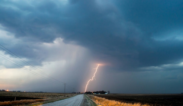
A rude awakening rolled across Cherokee County in East Tennessee early Monday as a severe thunderstorm warning lit up phones before sunrise, bringing howling winds, frequent lightning, and a tornado watch that kept night owls and early commuters on edge. The fast-moving line of storms raced over ridgelines and through valley towns, cutting visibility on the roads and knocking down limbs while forecasters warned that damaging gusts could take down trees and knock out power in rural stretches.
What the warning said
The National Weather Service office in Morristown extended a severe thunderstorm warning for Cherokee County through 5 a.m., noting that storms were lined up from about six miles east of Sweetwater to six miles east of Cohutta and tracking east at roughly 40 mph, according to the News & Observer. The bulletin flagged the potential for wind gusts up to 60 mph and urged anyone in the path to move to an interior room on the lowest floor of a sturdy building until the worst of the weather passed.
Tornado watch and lightning risk
Forecasters at the Morristown office stressed that a tornado watch would linger into the early morning hours and pressed residents to stay plugged in to local alerts and NOAA Weather Radio for any rapid changes in conditions, per the NWS Morristown forecast office. National weather officials also point out that lightning strikes the United States about 25 million times each year and kills roughly 20 people annually, and they recommend waiting a full 30 minutes after the last rumble of thunder before heading back outside, according to NWS lightning safety.
Towns in the path
The warning called out a string of communities and landmarks in the danger zone, including Madisonville, Benton, Ducktown, Etowah, Vonore, Tellico Plains, the William L. Davenport Refuge, the McGee Carson Peninsula, Big Frog Mountain, and Parksville, the News & Observer reported. Early-morning radar and spotter reports pointed to heavy downpours and repeated lightning strikes over those areas as utility and emergency crews stood by in case the wind started taking down lines or trees.
How to stay safe
Residents are encouraged to bring in or tie down loose outdoor items, brace for short power outages from fallen branches, and avoid driving until the most intense cells move through. Indoors, safety guidelines call for staying away from windows, steering clear of corded electronics, and sticking to the 30-minute rule after the last thunderclap before resuming outdoor activities, per NWS lightning safety.
For the latest watches, warnings, and local storm reports, check updates from the National Weather Service Morristown office on X, listen to NOAA Weather Radio, or follow local broadcasters. Detailed forecasts and hazard maps for East Tennessee are available through NWS Morristown.


