Jacksonville is waking up to a mostly cloudy, muggy start, sitting near 60°F with dew points in the upper 50s and humidity close to 90%. Clouds should thin out by midday, with skies trending mostly sunny and a high near 76°F, while the immediate coast hangs a few degrees cooler. Beachgoers should be on alert, as a high rip current risk remains in place through Tuesday evening.
Afternoon Winds Pick Up
East winds are expected to ramp up into the 10 to 16 mph range this afternoon, with higher gusts along the shoreline keeping the beaches cooler while inland spots warm more. A sea breeze pushing inland could spark isolated showers south of I‑10, although widespread rain is unlikely. Overnight lows will fall into the low to mid 60s, and where winds calm inland, patchy fog could develop before sunrise on Tuesday, March 31.
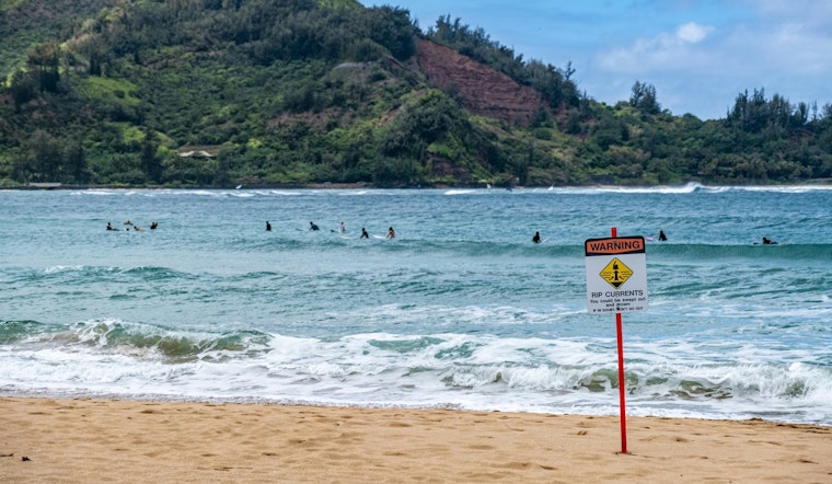
Beach Hazards And Marine Advisories
The National Weather Service has issued a Rip Current Statement that warns “Dangerous rip currents expected” at northeast Florida beaches through Tuesday evening. Breakers near 4 to 6 feet today and Small Craft Advisories offshore will make surf and boating hazardous, according to NWS Jacksonville. Swim only near lifeguards and avoid entering the surf alone. Boaters should delay trips offshore while advisories remain in effect.
Foggy Mornings, Sunny Afternoons
Patches of locally dense fog are likely to form late tonight and into the predawn commute on Tuesday, March 31, especially west of I‑95, which could reduce visibility in river valleys and on bridge approaches. Use low beams and leave extra stopping distance during the morning drive. A previous report on recent fog and surf impacts this month has more background on how these conditions have been affecting the area.
What To Expect This Week
Southeasterly flow will keep humidity and above-normal temperatures in place through the weekend, with mid 70s along the coast and low to mid 80s inland. Isolated afternoon showers are possible midweek. If you are heading to the beach, plan for rough surf and check posted lifeguard flags and local updates before going in.


