Sacramento is starting the day under clear skies and cool air, with temperatures near 48°F and enough overnight humidity to spin up low clouds and pockets of valley fog before the morning commute. The good news for anyone with lunch plans is that the sun should punch through by midmorning and lift afternoon highs into the mid-60s, setting up a pretty pleasant midday and afternoon.
Foggy Mornings, Sunny Afternoons
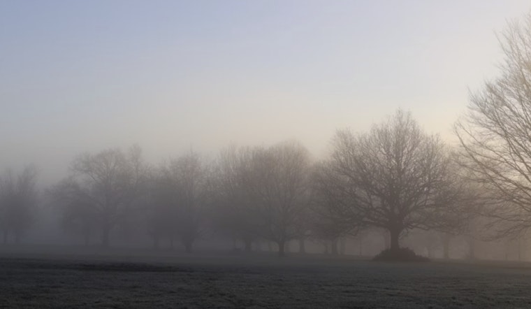
Overnight into the early morning, the main issue will be low clouds and patchy, at times locally dense, fog. It will be most noticeable in low-lying river corridors and spots near the Delta, where visibility can drop fast. Once the fog burns off, afternoons are expected to be mostly sunny with highs around 66°F through midweek, followed by a steady warmup toward the end of the week. Forecasters are only calling for light, isolated showers on Wednesday, mainly in the northern valley and foothills, with most of the Sacramento area staying dry. No watches or warnings are in effect right now, according to the NWS forecast discussion.
Midweek Showers and Late-Week Wind
Wednesday brings the best shot at light showers north of Highway 50 and over the higher terrain, while the interior valley is expected to remain mostly dry. A Pacific trough is lined up to deliver gusty north-to-east winds on Thursday and Friday, and forecasters see a 50 to 80 percent chance of gusts topping 30 mph along and west of I-5 and on exposed ridges. Plan on securing loose outdoor items and be ready for blustery stretches on exposed roads during those periods.
If you are out on the road early, give yourself extra time, stick with low-beam headlights in the fog, and avoid pulling over onto freeway shoulders until visibility improves. We covered a similar fog setup on February 13; check out Slow-Mo Commute for tips and past examples. The warming trend is expected to keep building into the weekend, with highs climbing into the mid-70s, which should mean generally nicer outdoor conditions once the morning gray burns off.


