Circleville is on flood watch as the Scioto River is forecast to crest at 16.1 feet on Friday, roughly a foot above the river's flood stage. A National Weather Service flood warning is in effect for Pickaway County, high-water signs are already posted near an underpass by the sheriff's office, and local officials are reminding residents that even seemingly shallow water can put both drivers and property at risk.
NWS forecast and local warnings
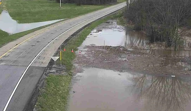
The National Weather Service has issued a flood warning for Pickaway County through Saturday, with forecasters expecting the Circleville river gauge to reach 16.1 feet, according to MyFOX28. Pickaway County Emergency Management director Tiffany Nash told the station that "It takes about six inches of water to sweep away a car," and urged drivers to keep their distance from barricades and water-covered roads.
Why a 16.1-foot crest matters
USGS monitoring for the Scioto River at Circleville shows that the gauge's defined flood stage is near 15 feet, so a 16.1-foot crest typically leads to low-land flooding and water over roads within the river corridor, according to USGS data. Past crests at that level have triggered temporary closures of low-lying streets and riverside park areas.
County preparations and alerts
Pickaway County's emergency management page lists Nixle and other alert sign-up options, along with contact information for the county EMA, and county officials say crews are monitoring the river and known trouble spots, according to the county site. Residents can enroll for notifications and review preparedness tips on the Pickaway County Emergency Management page.
Timing and safety reminders
The river is expected to drop back below flood stage by Saturday afternoon, MyFOX28 reported, though officials caution that water levels and flooding impacts can shift quickly. The National Weather Service's flood-safety guidance, including its "Turn Around, Don't Drown" campaign, urges drivers not to attempt crossing flooded roads and to obey barricades and posted warning signs, as outlined on the National Weather Service flood-safety page.


