New York City rolled out of bed to balmy, almost springlike weather on Wednesday, with temperatures hovering near 60 degrees across the five boroughs. Enjoy it while it lasts. A strong front is lining up for a late-day hit, set to flip the script with afternoon showers, evening thunder, and a sharp drop back into March reality by Thursday.
Afternoon: Warm Start, Showers Move In
Sun will hold on through the morning, helping temperatures climb into the low to mid 70s, with central neighborhoods likely topping out around 74 degrees before the weather turns. After midday, showers become increasingly likely.
According to the National Weather Service, there is about a 40% chance of showers this afternoon, and most of the city can expect a few tenths of an inch of rain. Isolated heavier downpours or a thunderstorm are possible, especially to the northwest of the city.
Tonight Into Thursday: Front Blasts Through, Temps Tumble
The cold front is expected to sweep through late Wednesday night into early Thursday, turning winds to the northwest and sending temperatures sliding from the 50s into the 30s by Thursday night. As the colder air pours in, lingering showers may briefly mix with wet snow late Thursday. Any flakes that do fall should be sloppy and are not expected to leave significant accumulations in most city neighborhoods. For more on the earlier warmth, see the spring tease that toasted New York on Tuesday.
Boaters And Commuters
Mariners should prepare for Small Craft Advisory conditions tonight into Thursday, with gusts in the 25 to 60 kt range and ocean seas building to 5 to 8 ft. Hazardous seas are expected to linger east of Fire Island into Thursday night.
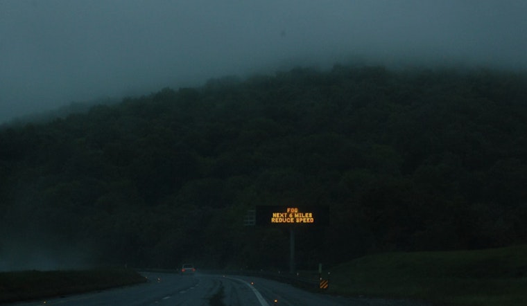
Dense pockets of fog remain possible this morning along eastern Long Island and the South Shore, and coastal terminals could see brief low ceilings or reduced visibility. On land, drivers should be ready for wet roads and gusty crosswinds as the front moves through.
Looking Ahead
Another, stronger system is set to arrive Sunday into Monday, bringing increasing rain and a stretch of strong southwesterly winds late Sunday night into Monday morning. For the city, most of that should fall as plain rain, though a brief wintry mix is possible both at the start and as the system exits.
Travelers should keep an eye on official forecasts as the weekend approaches and build in extra time for getting around during both the late-week and early-week wind and rain events.


