Jacksonville is waking up to a warm, soupy start, with mostly cloudy and muggy conditions around 68F and a south-southwest breeze. The calm will not last long. A strong cold front is set to barrel through on Monday, March 16, 2026, driving a line of showers and thunderstorms across the area this afternoon. Some of those storms could go severe, with damaging wind gusts and isolated tornadoes in the mix. Highs should spike near 80F before tumbling behind the front as winds flip to the northwest, with gusts up to about 35 mph in and just behind storms. Forecasters expect the leading edge of the squall line to roll into inland neighborhoods in the late morning, hit the I-95 corridor early in the afternoon and reach coastal spots later in the day.
Afternoon Storms May Turn Severe
Scattered to numerous thunderstorms are likely Monday, and the weather menu is not light. The main threats are damaging wind gusts, isolated tornadoes, hail and heavy downpours that could hammer visibility and slow commutes. Rainfall totals of a quarter to a half inch are possible, with locally higher amounts where storms linger. A Freeze Watch is also posted late Monday night into Tuesday morning for parts of inland southeast Georgia as much colder air pours in behind the front, setting up a sharp temperature swing, according to NWS Jacksonville.
Plan For Sudden Gusts And Lightning
Outdoor plans this afternoon may need a quick pivot. Move activities indoors and tie down or bring in anything that could turn into airborne yard decor once the gusts arrive. On the roads, heavy rain and falling branches could create delays and hazards, so build in extra travel time and steer clear of flooded streets. For background on the warm, muggy week that set the stage for today’s fireworks, check out how sea fog and pop-up storms tag team the city.
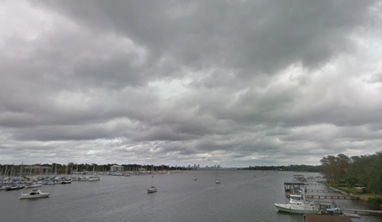
Boaters And Beachgoers
Conditions on the water are expected to go rough in a hurry. Small Craft Advisory conditions are expected to develop this morning and continue into Tuesday, March 17, 2026, with thunderstorms over the water capable of producing dangerous gusts, large waves and the potential for waterspouts. At the beaches, a moderate rip-current risk is on tap with surf around 24 feet, so swimming should be limited to lifeguarded areas and beachgoers should keep an eye on posted flags. Boaters are urged to delay nonessential trips, and marinas should secure vessels, according to NWS Jacksonville.
Tuesday Cool Down And Freeze Watch Inland
Once the front clears, Tuesday, March 17, 2026, brings a completely different feel. Much cooler, drier air will settle in with highs only in the mid-50s and brisk northwest winds keeping things feeling even chillier. Late Monday night into Tuesday morning, lows will tumble into the 30s for many inland spots, so gardeners should protect sensitive plants and cover tender vegetation before sundown. Coastal neighborhoods will hang on to slightly milder readings, generally in the upper 30s to low 40s overnight.


