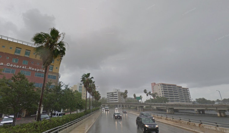
Clear skies and comfy lows in the low 70s in Tampa this morning will be short lived. Forecasters say a broken line of showers and thunderstorms is expected to roll through this afternoon into the evening, bringing heavy downpours and gusty winds that could snarl the afternoon commute and put a damper on beach plans.
Afternoon Storms And Timing
A slight chance of rain is on the table between 10 and 11 a.m., with storms becoming likely between 11 a.m. and 1 p.m. and continuing into the evening, according to the National Weather Service Tampa Bay Ruskin. The office says some storms could be strong to severe, capable of producing damaging wind gusts and a low chance for brief, quick spin tornadoes. New rainfall amounts of about one half to three quarters of an inch are possible, with south southwest winds of 8 to 14 mph and gusts up to 24 mph, so anyone out and about in the afternoon may want the rain gear close at hand.
Update From Hoodline
This piece updates our earlier coverage of steamy near-record heat before storms crash the party and reflects new timing and advisories issued for Monday. We will update again if the National Weather Service upgrades watches or issues warnings for the area.
Beach And Boating Hazards
According to the National Weather Service Tampa Bay Ruskin, a Rip Current Statement is in effect from today afternoon through Tuesday evening for Pinellas, coastal Hillsborough, Manatee, Sarasota, Charlotte and Lee counties, and Small Craft Advisories cover portions of the gulf and bay waters. Swimmers are urged to stay near lifeguards and avoid the surf when storms are in the area. Boaters should be ready to head for safe harbor if a squall approaches and be prepared for sudden gusts and dangerous lightning.
Cool Down Behind The Front
Once the front clears, the air turns noticeably cooler and drier. Highs on Tuesday should struggle into the low 60s, with overnight lows dipping into the 40s and mid to upper 30s possible across parts of the Nature Coast, cold enough for patchy frost in a few inland spots if winds relax overnight. Conditions gradually moderate later in the week, with highs climbing back into the upper 70s by Friday, so the cool snap will be brief but noticeable.


