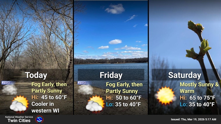
On Thursday, March 19, 2026, Minneapolis woke up to a murky morning commute, with thick, low fog and pockets of freezing mist around MSP and temperatures hanging in the mid-30s. Visibility dropped in spots, slowing traffic on freeways and bridges. The payoff for the patience: forecasters say the sun should break through by mid-morning, pushing highs into the upper 40s and chewing through much of the remaining snow.
Dense Fog Advisory Slows the Morning Rush
The National Weather Service Twin Cities has a Dense Fog Advisory in effect until 11 AM CDT for many southern and central counties, and early observations at KMSP showed fog and reduced visibility. Drivers can expect patchy visibility under a mile in some areas, so slow down, use low-beam headlights, and leave extra stopping distance. Travelers and pilots should check with airlines and airport advisories, as MVFR conditions are possible through mid-morning.
Sun Breaks Through, Snow Piles Shrink Fast
Once the fog lifts, milder air should nudge temperatures to about 49F this afternoon and into the low- to mid-50s on Friday, which forecasters say will rapidly melt much of the remaining snowpack, likely gone by the end of today or by Friday. That quick melt can leave slushy streets, soggy lawns, and standing water in low spots, and any leftover moisture could refreeze overnight on shaded surfaces. For more background on recent wintry swings, see our coverage of patchy fog and snow flurries.
Weekend Warm-Up Before a Quick Cool-Down
Friday should be partly sunny with a high near 54F, and Saturday looks unusually warm, with highs near 70F in parts of the region, before a backdoor cold front brings a slight chance of isolated light showers Sunday evening and a cooler high near 43F on Sunday. Saturday night lows will dip into the upper 30s, so puddles could refreeze in sheltered areas if temperatures fall quickly. Overall, expect a quieter pattern next week with mostly dry conditions and seasonable readings returning by Monday.
What Travelers and Commuters Need to Know
Plan extra time for the morning drive and keep headlights on in foggy stretches; local transit should be running, but check service alerts for minor delays. If you have outdoor plans, aim for the afternoon when it will be warmest and sunniest. For the latest advisories and flight updates, check the National Weather Service Twin Cities and your airline before heading out.


