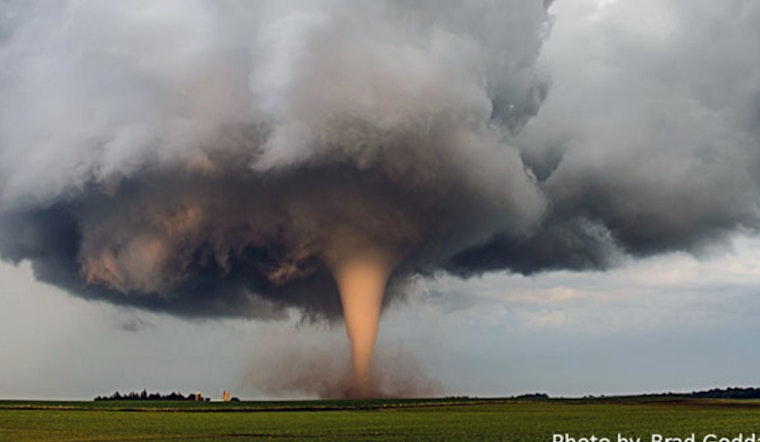
A fast-moving line of severe thunderstorms has much of Louisiana on edge Wednesday, with a tornado watch now covering 19 parishes across central, western and northern parts of the state. The watch runs through 6 p.m. CDT, stretching from the Texas border east through Rapides Parish toward Ouachita Parish, and local officials are urging residents to keep phones charged and have more than one way to get alerts in case the weather turns ugly in a hurry.
SPC Issues Tornado Watch 44
The NWS Storm Prediction Center issued Tornado Watch 44 at 11:25 a.m. CDT, placing much of western, central and northern Louisiana under watch through 6 p.m. CDT. Forecasters there warn thunderstorms could spin up “a few tornadoes and a couple intense tornadoes,” along with scattered damaging wind gusts up to around 70 mph and isolated large hail.
Parishes Named in the Watch
According to the Storm Prediction Center, “the tornado watch area is approximately along and 60 statute miles north and south of a line from 60 miles west northwest of Houston TX to 15 miles northeast of Alexandria LA.” Within that zone are 19 Louisiana parishes: Allen, Avoyelles, Beauregard, Calcasieu, Caldwell, Cameron, De Soto, Evangeline, Grant, Jackson, Jefferson Davis, La Salle, Natchitoches, Ouachita, Rapides, Red River, Sabine, Vernon and Winn. Towns including Alexandria, Natchitoches, Winnfield and Monroe sit within or near the watch area and should keep a close eye on updates.
Storm Timing and Travel Impacts
Forecasters expect the main line of storms to roll through during the afternoon commute, a worst-case timing scenario for anyone on the road. Drivers along I-10 near Lake Charles and I-49 near Alexandria may see sudden downpours and sharply reduced visibility, according to Country Herald. That report also underscores the risk of rapid storm intensification and damaging gusts across southwest and central parishes, which could knock down branches and trigger localized power outages, so plan extra time and caution if you have to travel.
If a Warning Is Issued
If a tornado warning is issued, the National Weather Service urges people to move immediately to an interior room on the lowest floor of a sturdy building and avoid windows. Turn on wireless emergency alerts and a NOAA Weather Radio, keep phones charged and away from glass, and follow local emergency channels for any sheltering instructions, according to the National Weather Service.
This story will be updated as conditions change. For the initial local summary and additional context, see Country Herald.


