Jacksonville wakes up under cloudy skies in the low 60s this morning, with a stiff northeast wind already near 15 mph and gusts pushing into the mid-20s. A High Surf Advisory and a High Rip Current risk are in effect at area beaches, and a short window of showers and isolated thunderstorms is expected later today. The best shot at storms lands between about 1 p.m. and 3 p.m. EDT Wednesday, March 25, with highs only near 72°F along the coast.
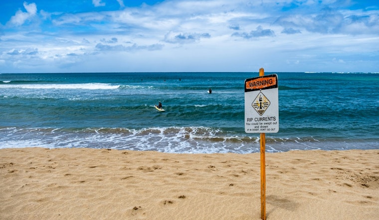
High Surf, Dangerous Rip Currents
Breaking waves of roughly 4 to 7 feet and dangerous rip currents are expected along Northeast Florida beaches, making swimming and surfing hazardous early today. The High Surf Advisory is set to run into the early afternoon and the rip-current threat is expected to hang on through late tonight, so sticking to lifeguarded beaches will be the safest call. Read the National Weather Service for full details.
Afternoon Showers And Gusty Onshore Winds
Rain chances peak in a tight afternoon window, with brief heavy downpours or isolated thunderstorms most likely between about 1 p.m. and 3 p.m. EDT Wednesday, March 25. Northeast winds around 15 mph, with gusts up to the mid-20s, could make beaches and small craft uncomfortable even outside the showers. We ran a March 5 story about early-morning fog and elevated rip-current risk; today's advisory supersedes that earlier notice and warns of a fresher surge of surf along the coast, so see early-morning fog and rip risk for background.
What To Know Before You Head To The Beach
Inexperienced swimmers should stay out of the water, and anyone who does enter the surf should swim only near a lifeguard and never alone. If you get caught in a rip current, float and signal for help instead of trying to fight the pull back to shore. Boaters and paddlers should treat today as rough, since small craft advisories are in effect for portions of the local waters and seas will be elevated.
Short Term Outlook
Skies should start to clear Thursday, March 26, with patchy morning fog giving way to sun and highs near 80°F, and a stronger warm-up is expected inland on Friday, March 27 when readings could climb into the mid- to upper-80s. The pattern turns breezier again over the weekend, with cooler afternoons Saturday and a return to onshore flow that will keep the coast cooler than inland spots. Check the National Weather Service or local outlets before heading out to the water on Thursday and beyond for any advisory changes.


