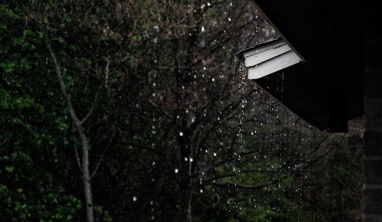
Raleigh rolled out of bed under mostly cloudy skies and a mild 68°F this morning, but the calm start will not last. A cold front is marching in, bringing a slight chance of showers between 11 a.m. and noon on Sunday, April 5, 2026, followed by more widespread showers and thunderstorms in the afternoon that could linger into the evening. Highs should climb into the mid 70s, near 76°F, and gusts up to 25 mph could turn the late afternoon drive into a slow crawl.
Afternoon Storms And Commute Impacts
According to the National Weather Service in Raleigh, scattered showers and a few strong to severe thunderstorms are likely this afternoon, especially east of US 1 where a marginal severe risk remains in place. Most spots are expected to pick up between one quarter and one half inch of rain, with localized totals up to 0.75 inch, and the main concern with any stronger storm cells will be damaging wind gusts. Winds will blow from the southwest ahead of the front, then swing around to the northwest once the line moves through.
Timing And Where It Will Hit Hardest
Hourly forecasts show storm chances jumping above 60% by early afternoon, with the highest odds for thunderstorms between about 1 p.m. and 6 p.m. The northwest Piedmont should stay a bit cooler with highs in the upper 60s to low 70s, while the Sandhills and Coastal Plain warm into the mid 70s to low 80s, a setup that can help juice up those afternoon storms. The main line is expected to shift east during the evening, with drier air sliding in overnight and lows dipping into the upper 40s to around 50°F.
Late-Week Flip: Dry Air And Frost Risk
The National Weather Service office also flags a sharp pattern change starting Monday, as much drier air settles in and a reinforcing shot of cold could bring widespread frost on Wednesday and Thursday mornings, April 8 and April 9, 2026. The frost risk looks highest across the Piedmont and the northern and central Coastal Plain. Forecasters add that afternoon relative humidity may drop below 40% through much of the work week, which could raise fire weather concerns as early as Tuesday. Gardeners will want to protect sensitive outdoor plants before those colder nights arrive.
What You Should Do
Plan on grabbing a rain jacket and building in extra travel time if you are out Sunday afternoon, since brief heavy downpours and gusty winds can quickly slow traffic and cut visibility. Secure loose outdoor furniture, keep an eye out for weak limbs or branches that could come down in gusts up to about 25 mph, and check GoRaleigh for any bus or service updates if you rely on transit. For more on the setup behind this stormy-to-chilly swing, see how Sunday's storms line up.


