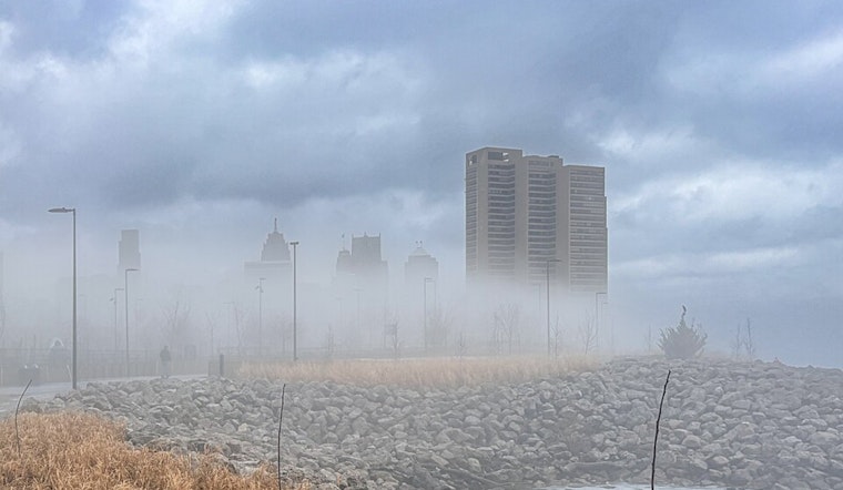
Detroit drivers are crawling through a thick soup of fog this morning, with visibility in spots trimmed to roughly a quarter mile and temperatures hovering near 54°F. Expect slower traffic, longer stopping distances, and plenty of brake lights until the low clouds start to thin later this morning.
Dense Fog Advisory Through 10 AM
The National Weather Service has a Dense Fog Advisory up for southeast Michigan until 10 AM EDT today, with visibility of one-quarter mile or less possible. If you have to hit the road, flip on the low-beam headlights, ease off the gas, and leave extra room between you and the car ahead. Conditions should gradually improve late this morning as daylight helps mix out the fog.
Thunderstorms Late Tonight Into Saturday
A strong cold front is set to shove showers and thunderstorms into the region late tonight into early Saturday. The best window for thunder looks to be roughly between 2 and 4 AM tomorrow. A few storms could pack brief heavy downpours and gusty winds, so anyone out late should plan on slower travel and reduced visibility at times.
Flooding Concerns And Weekend Chill
The National Weather Service is calling for basin-wide rainfall totals of about one-half inch to locally one inch between late tonight and midday tomorrow, enough to worsen ponding on roads and aggravate already elevated river levels in some spots. Behind the front, temperatures fall sharply, with highs in the upper 60s today sliding into the 40s by Sunday and chilly lows near the 20s by next Monday morning. It is a good idea to secure lightweight outdoor items and avoid driving through standing water where possible.
Plan Ahead
Build in extra time for this morning's foggy commute, keep those headlights on in low visibility, and check updated forecasts and local traffic reports before heading out tonight. Skies should gradually improve tomorrow into early next week as drier, cooler air settles over the region.


