New Orleans wakes up to cloudy skies and a mild 68°F (20°C) Thursday morning, with the day set to turn breezy and warm as we head into April 9, 2026. A Coastal Flood Advisory runs from 11 AM to 8 PM CDT, and Small Craft Advisories are in effect for local waters, with a high near 74°F expected this afternoon. Gusty east winds could help push water into the usual trouble spots, so minor ponding on low-lying streets is possible during the afternoon high-tide cycles.
Afternoon Winds Pick Up
East winds are expected around 10–15 mph with gusts up to 25 mph inland. Gusts will be stronger closer to the shore and on exposed bridges, where the afternoon commute may feel more blustery than usual. Those bursts of wind can toss around unsecured outdoor items, so it is a good day to tie down patio furniture, grills and trash bins. Drivers using riverfront or lakeside routes should be ready for sudden crosswinds on exposed spans.
Marine Conditions And Tides
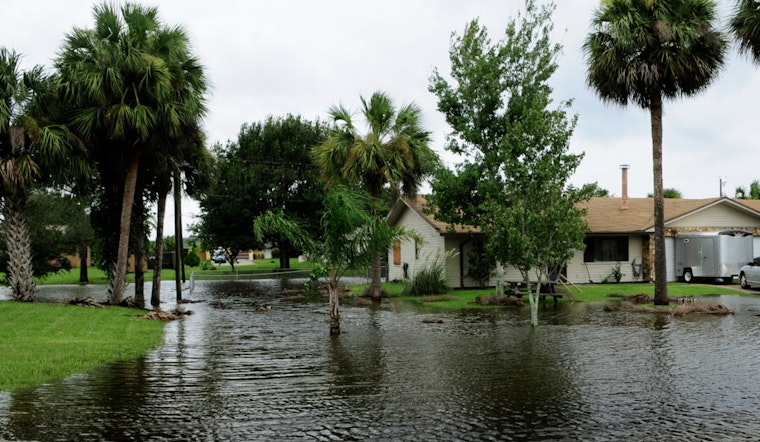
According to the National Weather Service, hazardous marine conditions will persist today with Small Craft Advisories in place and open-water wave heights around 7–10 feet. The same forecast notes that spring tides combined with a prolonged easterly fetch could push minor coastal flooding onto east-facing shores. The Coastal Flood Advisory calls for pockets of flooding up to about 1 foot at afternoon high tides, which could inundate lots, parks and some low-lying roads, with only isolated road closures expected. Inexperienced boaters and operators of small craft are urged to stay in port until conditions improve.
What To Do Today
Secure loose outdoor gear and hold off on recreational boating while advisories are active. Never drive through standing water and do not weave around barricades. Build in a little extra travel time if your commute runs along east-facing shorelines, and check local traffic updates if you plan to drive near the lake or river. For background on the wind pattern and coastal setup, see our earlier explainer on the wind and coastal setup.
Outlook
Winds should ease after sunset and coastal conditions will gradually improve into Friday, though some marine advisories may linger near the coast into the weekend. Temperatures will trend warmer with highs in the upper 70s to low 80s through next week, with only isolated shower chances, setting up a mostly dry and pleasant weekend.


