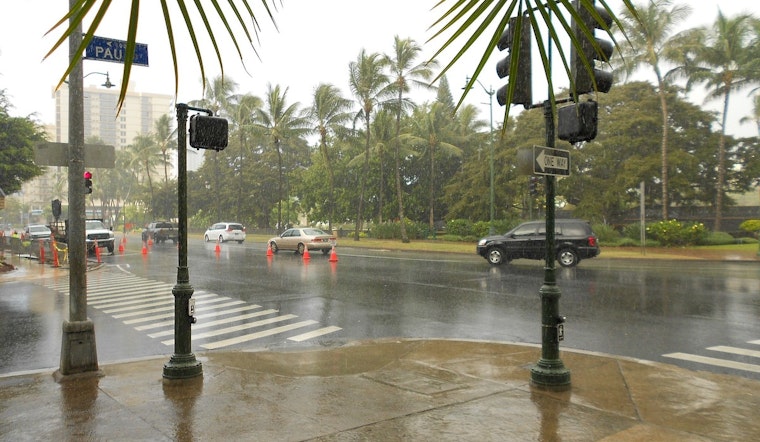
Honolulu woke up Tuesday (April 14, 2026) to that classic “step-outside-and-you’re-already-sweating” kind of morning. An early observation at Daniel K. Inouye International Airport showed mostly clear skies and a temperature near 73°F, with the dewpoint hovering around 70°F, which is why it felt so muggy even before breakfast. With light winds on tap, the main nuisance for the morning and evening drive will be brief, passing showers, so tossing an umbrella in the car would not be the worst idea. Inland spots should still manage to warm into the low 80s this afternoon.
What To Expect Today
Scattered showers will be lurking through Tuesday, with a daytime high near 83°F and about a 30 to 40 percent chance that any given spot sees some rain. The good news is most of those downpours should be quick hitters, generally dropping less than a tenth of an inch before moving along. Winds out of the south-southeast should stay on the light side around 3 to 9 mph, which means roads can turn slick in places but widespread flooding is not in the cards based on the current forecast. That outlook comes from the National Weather Service forecast discussion at NWS Honolulu.
Through The Week
The theme through the rest of the week is more of the same: showery and humid. A band of showers will drift east across the islands while a moisture-laden airmass keeps dewpoints elevated, so that sticky feel is likely to hang around. Lighter east-to-southeast trade winds may try to return toward the end of the week, but an upper-level trough edging closer could help ramp shower coverage back up by the weekend. Highs should hold near the low 80s with overnight lows in the mid-70s, and forecasters are not posting any watches or warnings for the islands at this time.
Outdoors, Surf And Travel
Out on the water, a small northwest swell is set to gradually fade, while a shorter-period south swell could give south-facing breaks a modest bump later in the week. East-facing shores should stay below seasonal surf averages for now. Boaters and paddlers should keep an eye on typically windy channels, especially if trades strengthen from Friday into the weekend. On the roads, drivers would be wise to budget a little extra time for scattered wet patches along main routes. For more background on the ongoing wet pattern, check out our April 5 story.


.jpg)