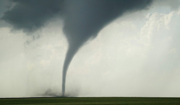
A quiet Monday afternoon in Pike County, Missouri, turned tense when a Tornado Warning snapped into effect and residents were urged to dive for shelter as rotating thunderstorms rolled across the county. Emergency managers and local broadcasters stressed that anyone in mobile homes or vehicles was particularly exposed to flying debris, with radar showing tight pockets of rotation in several storm cells tracking east-northeast.
Local TV coverage, including KSDK, pushed an all-caps-style message to viewers: "Take shelter now." The station flagged Pike County inside the warning polygon and, in an update posted at 4:18 p.m. CDT, warned that the storms could bring damaging winds and large hail on top of the tornado threat. On live video, station meteorologists repeatedly pressed anyone in the path to move immediately to a safe spot.
The National Weather Service in St. Louis said the warning covered parts of Pike County and instructed residents to "Move to an interior room on the lowest floor of a well-built building away from windows." Forecasters labeled the hazard a radar-indicated tornado and warned that "flying debris will be dangerous to those caught without shelter." The bulletin also laid out storm motion, specific coordinates and towns inside the warning polygon so first responders could zero in on where to stage resources.
Why Forecasters Zeroed In On Pike County
Meteorologists had circled the day well before the sirens went off. The setup favored fast-growing, intense thunderstorms across the mid-Mississippi Valley, and Weather.com reported that the Storm Prediction Center placed parts of Missouri and Illinois under a 4-out-of-5 severe risk on Monday. That higher-end outlook reflected a volatile mix of wind shear, moisture and instability that can fuel long-track, strong tornadoes and very large hail. The broader region had already logged multiple tornado and large-hail reports earlier in the ongoing multi-day outbreak.
Safety Steps For Residents
Officials say that if you are in the warning polygon, the time for debating is over: head to the lowest, most interior room you can reach and stay away from windows. The American Red Cross stresses that a tornado WARNING means take action now, not later, and that basements or interior hallways of sturdy buildings offer the best protection. Mobile homes and vehicles are not considered safe. Residents are urged to keep a battery-powered radio or charged phone handy for updates and to check on neighbors if they can do so safely between storm cells.
Where The Warning Was In Effect
National Weather Service products show that Monday's tornado watch and many of the individual warnings swept over parts of Pike County and nearby communities, including Bowling Green, Louisiana and New London. The watch covering the area, Tornado Watch 160, listed Bowling Green and Pittsfield among the cities inside the risk area, according to the National Weather Service. Responders warned drivers to avoid I-72 and local farm roads while the storms were active and the tornado threat remained in play.


