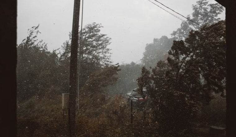
Cloudy, muggy air settled over Atlanta early Sunday as a stout line of showers and thunderstorms moved in on April 5, 2026. Temperatures around Hartsfield‑Jackson and nearby Peachtree City are hovering near 68°F, with thick humidity and low clouds hanging around. Bursts of heavy rain and pockets of thunder could slow the morning into afternoon commute.
Rain And Thunder Timing
A line of showers and thunderstorms is expected to track southeast across the metro from early this morning into mid‑afternoon, with the best shot at steady rain from late morning through about 4 p.m. Showers and storms are likely across much of the area, and new rainfall between a half and three quarters of an inch is possible, with some spots topping an inch where the heaviest downpours set up. Widespread severe weather is not on the table, but forecasters note a few storms could kick out small hail and wind gusts up to 40 mph. Low ceilings and reduced visibility are likely at area airports until the front slides through and conditions improve, with winds flipping to the northwest and gusting near 20 mph, according to the National Weather Service office in Peachtree City.
Afternoon Winds And Commute
Winds will turn from the southwest this morning to the northwest by afternoon, generally 5–10 mph with stronger gusts in exposed spots. That breeze, paired with heavy downpours, can leave ramps and bridges especially slick. Drivers should budget some extra time, and cyclists may want to stick to more sheltered routes later in the day. For background on the setup and what to expect through the weekend, see our earlier look at steamy afternoons and surprise storms.
Looking Ahead
Behind the line, a cold front will usher in drier air and near‑normal temperatures on Monday, April 6, with highs around 70°F and mostly sunny skies. The rest of next week trends drier as well, with a warmup into the mid‑70s by Tuesday and upper‑70s to low‑80s possible by late week, a return to more typical spring readings. Keep an eye on forecast updates if you are planning outdoor events later in the week.


