San Jose is waking up to a gray, soggy today, with clouds and about 59°F recorded early at Mineta San José International Airport and showers already drifting across the South Bay. Temperatures should climb toward 69°F before cooling into the mid 60s later in the day as waves of scattered downpours move through.
The main band of rain is expected to slide through overnight, and forecasters say the system will organize further tomorrow, bringing widespread rain and embedded thunderstorms. The National Weather Service is calling for 1 to 2 inches of rain for many spots, with up to 4 inches possible in favored coastal ranges through Sunday, while lower valley locations should see smaller totals. Most urban neighborhoods are on track to land in the few-tenths-of-an-inch range, although training showers or a slow-moving thunderstorm could still trigger brief, localized flooding.
Timing And Local Impacts
Showers and thunderstorms are likely on and off today and tonight, with another push of stronger activity expected tomorrow afternoon into tomorrow night. Highs should reach near 69°F today, then drop toward the low 50s by late tomorrow night. Any thunderstorms could deliver lightning, small hail and quick bursts of erratic wind, with forecast gusts around 21 mph and potentially into the upper 20s tomorrow. Drivers should be ready for sudden downpours that cut visibility and create ponding on low-lying streets, which will slow travel during the heaviest showers.
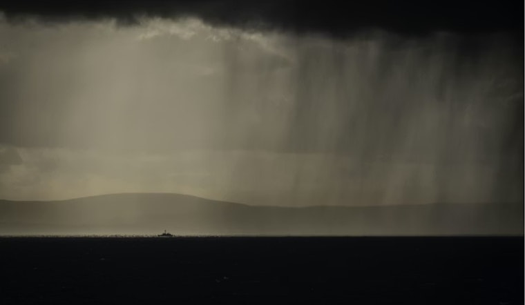
Coast And Boaters
Conditions over the water are not looking friendly. National Weather Service marine products include Small Craft Advisories for parts of Monterey Bay tomorrow, along with gusts that could approach gale force across more exposed waters. Boaters and shoreline anglers are urged to have a quick escape route to safe harbor ready for when the weather turns, with the NWS reminding everyone, "When thunder roars, head indoors."
On land, motorists should watch for rapid visibility drops in heavier bursts of rain and allow extra time on slick roads, while transit riders may face delays and should check agency alerts before heading out. This story updates the April 8 forecast in our earlier thunderstorm forecast with fresh timing and advisory details from the NWS.
If you have outdoor plans tomorrow, it is a good idea to pack a rain jacket, keep some indoor alternatives in your back pocket and secure or move any loose items outside. Keep an eye on short-term radar and updates from the National Weather Service over the weekend for the latest timing and any watches that may be issued.


