Philadelphia woke up Saturday, April 25, 2026, to a chilly soak, with light rain and temperatures hovering near 50°F and an onshore east wind keeping the whole scene raw and unpleasant. Showers are expected to pick up through the morning and afternoon, with the steadiest and heaviest rain arriving tonight.
Afternoon Into Tonight
Rain showers are likely across the city through this morning and into the afternoon, with a daytime high near 56°F before temperatures slide back into the upper 40s. This evening, the rain becomes more persistent and could deliver 1 to 2 inches of accumulation overnight in most spots, with locally higher totals still on the table.
East winds will run about 5 to 15 mph during the day, then increase to 10 to 15 mph tonight with gusts up to 25 mph. Out over the coastal waters, seas build to 4 to 7 feet today and 6 to 10 feet tonight, prompting Small Craft Advisories and a Gale Watch for some Atlantic zones. For full timing and the latest advisories, see the NWS Mount Holly forecast.
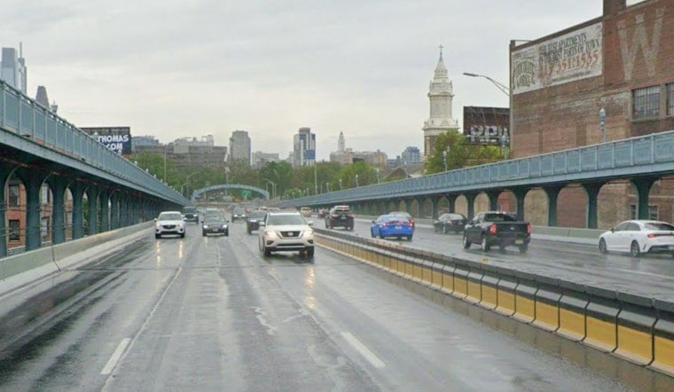
What This Means For Your Commute
Drivers and riders should plan on slower trips this evening and into Sunday morning where steady rain and gusty east winds overlap, and reduced visibility and standing water could stack up delays on surface streets. Leave extra time to get where you are going, and check transit alerts before you head out, since Regional Rail and buses may be running slower than usual.
For a look at how this soggy setup started earlier in the week, see our coverage of the morning drip before the spring flip.
Looking Ahead
After a brief break on Monday, another frontal boundary could bring light rain late Tuesday, and a stronger low may spread more widespread showers across the area late Wednesday into Thursday. Highs are expected to bounce back into the 60s by midweek, according to the NWS Mount Holly forecast. Keep an eye on updates before you plan late-week travel, since timing and totals could still shift as these systems evolve.


