Knoxville is slogging through a cloudy, muggy start on Wednesday, April 29, 2026, with temperatures near 66°F and showers and thunderstorms already on the move. The heaviest action is expected between roughly 8 a.m. and 11 a.m., with a daytime high near 76°F. West winds will crank up this afternoon, and gusts near 25 mph could make the commute feel pretty blustery.
Expect the main window of heavier rain and embedded storms to fall in that 8–11 a.m. period, with brief downpours that could drop a tenth to a quarter of an inch and cut visibility on wet roads, according to the National Weather Service Morristown. The office puts Wednesday’s rain chances at about 80% and notes west winds of 10–15 mph, with stronger gusts possible. Overnight turns mostly cloudy with lows near 51°F as drier air settles in.
Afternoon Winds Pick Up
By this afternoon, winds swing around to the west and become the main thing you will notice if you are out and about. Sustained speeds of 10–15 mph with gusts near 25 mph are possible, and exposed bridges and hilltops will feel the punch the most. Those gusts can make umbrella use pretty futile and will toss around lightweight patio items, so it is worth securing any loose outdoor gear. Smaller general aviation flights and ground operations at local airports may see brief gust-related delays.
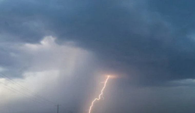
Short-Lived Severe Threat Wednesday Afternoon
There is a short window Wednesday afternoon into early evening, roughly 3–7 p.m., when a few storms could briefly become strong to severe, mainly across Northeast Tennessee and into southwest Virginia. The primary concerns would be gusty winds and small hail around quarter size. The overall severe risk stays low but is focused in areas where storms manage to organize, so keep an ear out for updates if you have late-afternoon outdoor plans.
What To Expect Later This Week
Rain should taper Wednesday night as a cooler, drier air mass moves in. Thursday looks mostly sunny with highs near 69°F and lighter north winds. Rain chances trend downward for Friday night into Saturday, so most weekend plans are on track for drier conditions.
This piece updates earlier coverage of back-to-back storm rounds. For context and last night’s evolving gust wording, check our April 28 write-up: Fog, Thunder And 50 Mph Blasts Rattle Knoxville Morning Rush. We will post any watches or warnings if the situation escalates.
On the roads, slow down in heavy rain, leave extra stopping distance, and never drive through standing water. Make sure wireless emergency alerts are enabled on your phone and keep an eye on local broadcasters if you will be out during the heavier rain windows.


